Wilani
Wilani (Aymara wila blood, blood-red,[2][3] -ni a suffix to indicate ownership, "the one with red color", Hispanicized spelling Huilane) is a mountain in the Andes of Peru, about 5,200 metres (17,060 ft) high . It is located in the Arequipa Region, Arequipa Province, Tarucani District, and in the Moquegua Region, General Sánchez Cerro Province, on the border of the districts Coalaque and Matalaque. Wilani lies southwest of Pukasaya, northwest of Ch'awarani and northeast of Qillqata.[1]
| Wilani | |
|---|---|
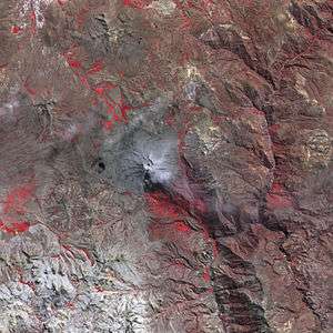 The Ubinas volcano and Wilani southwest of it (lower left) as seen from above (NASA, 2006) | |
| Highest point | |
| Elevation | 5,200 m (17,100 ft) [1] |
| Coordinates | 16°28′50″S 70°58′45″W |
| Geography | |
 Wilani Peru | |
| Location | Peru, Arequipa Region, Moquegua Region |
| Parent range | Andes |
References
- escale.minedu.gob.pe - UGEL map of the General Sánchez Cerro Province (Arequipa Region)
- Radio San Gabriel, "Instituto Radiofonico de Promoción Aymara" (IRPA) 1993, Republicado por Instituto de las Lenguas y Literaturas Andinas-Amazónicas (ILLLA-A) 2011, Transcripción del Vocabulario de la Lengua Aymara, P. Ludovico Bertonio 1612 (Spanish-Aymara-Aymara-Spanish dictionary)
- "Diccionario Quechua - Aymara al español". katari.org. Retrieved January 12, 2014.
This article is issued from Wikipedia. The text is licensed under Creative Commons - Attribution - Sharealike. Additional terms may apply for the media files.