Wetterkreuzberg
The Wetterkreuzberg (400.7 m above NHN)[1] is a hill in the Haardt range on the eastern edge of the Palatine Forest in the German state of Rhineland-Palatinate.
| Wetterkreuzberg | |
|---|---|
 The Wetterkreuzberg seen from Maikammer | |
| Highest point | |
| Elevation | 400.7 m above sea level (NHN) (1,315 ft) |
| Coordinates | 49°18′45″N 8°06′26″E |
| Geography | |
 Wetterkreuzberg | |
| Parent range | Haardt, Palatine Forest |
| Features | Chapel of Maria-Schutz-Kapelle |
Location
The Wetterkreuzberg, like the Breitenberg (545.2 m), the Taubenkopf (603.8 m) and the Kanzel (531.7 m), is one of the outlying peaks of the Kalmit massif (672.6 m).[1] It is located in an exposed location right on the edge of the Haardt so that, despite its low elevation, it is seen from places in the Rhine Plain as a prominent peak. To the north the hill is linked to the Kanzel over a shallow saddle. At the summit is a chapel to St. Mary (the Maria-Schutz-Kapelle) which is visible from a long way off. The hill belongs to the parish of Maikammer.
The Kalmitstraße road,[1] which runs from Maikammer to the Hüttenhohl runs across the hill. Just below the summit there is a walker's car park. The summit may be gained on footpaths from the Maikammer hamlet of Alsterweiler, from St. Martin or even from the Klausental Hut.
Gallery
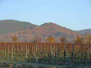
 The Kalmit Massif seen from Maikammer with the Breitenberg, Kalmit, Kanzel and Wetterkreuzberg
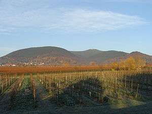
 The Wetterkreuzberg seen from Sommerberg
 The summit
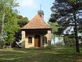 The chapel on the Wetterkreuzberg
 Altar of the chapel on the Wetterkreuzberg
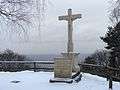 The Wetterkreuz
References
- Map services of the Federal Agency for Nature Conservation
External links
| Wikimedia Commons has media related to Wetterkreuzberg (Haardt). |