Wellesley Islands
The Wellesley Islands are a group of islands off the coast of north Queensland, Australia, in the Gulf of Carpentaria.[2] They are a locality within the Shire of Mornington local government area.[3] In the 2016 census, Wellesley Islands had a population of 1,136 people.[1]
| Wellesley Islands Queensland | |||||||||||||||
|---|---|---|---|---|---|---|---|---|---|---|---|---|---|---|---|
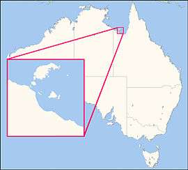 Location map | |||||||||||||||
 Wellesley Islands | |||||||||||||||
| Coordinates | 16.5329°S 139.3881°E | ||||||||||||||
| Population | 1,136 (2016 census)[1] | ||||||||||||||
| • Density | 1.1279/km2 (2.9212/sq mi) | ||||||||||||||
| Postcode(s) | 4871 | ||||||||||||||
| Area | 1,007.2 km2 (388.9 sq mi) | ||||||||||||||
| Time zone | AEST (UTC+10:00) | ||||||||||||||
| LGA(s) | Shire of Mornington | ||||||||||||||
| State electorate(s) | Traeger | ||||||||||||||
| Federal Division(s) | Kennedy | ||||||||||||||
| |||||||||||||||
Geography
The largest island in the group is Mornington Island. Two small islands in the group form the Manowar and Rocky Islands Important Bird Area because of their importance for breeding seabirds.[4] The South Wellesley Islands and the Forsyth Islands are in the same area and all are the local government area of the Shire of Mornington. They form subregion GUP10 of the IBRA Gulf Plains bioregion of Australia.[5][6]
History
Lardil (also known as Gununa, Ladil) is an Australian Aboriginal language spoken on Mornington Island and the Northern Wellesley Islands, within the local government boundaries of the Mornington Shire.[7]
They were named by Matthew Flinders in honour of Richard Wellesley, 1st Marquess Wellesley.
Mornington Island State School opened on 28 January 1975.[8]
Indigenous origin myth
According to indigenous belief, possibly mixed with fact, the islands were once part of mainland Australia:[9]
In the beginning, as far back as we remember, our home islands were not islands at all as they are today. They were part of a peninsula that jutted out from the mainland and we roamed freely throughout the land without having to get in a boat like we do today. Then Garnguur, the seagull woman, took her raft and dragged it back and forth across the neck of the peninsula letting the sea pour in and making our homes into islands.
Education
Mornington Island State School is a government primary and secondary (Early Childhood-10) school for boys and girls at Lardil Street (16.6663°S 139.1825°E).[10][11] In 2017, the school had an enrolment of 245 students with 24 teachers and 12 non-teaching staff (9 full-time equivalent).[12] It includes a special education program.[10]
There are no schools offering education to Year 12 on the island; nor are there any nearby.[8] Distance education or boarding school would be the only options.
See also
References
| Wikimedia Commons has media related to Wellesley Islands. |
- Australian Bureau of Statistics (27 June 2017). "Wellesley Islands (SSC)". 2016 Census QuickStats. Retrieved 20 October 2018.

- "Wellesley Islands (entry 36965)". Queensland Place Names. Queensland Government. Retrieved 15 February 2017.
- "Wellesley Islands - locality in Shire of Mornington (entry 42536)". Queensland Place Names. Queensland Government. Retrieved 11 November 2019.
- BirdLife International. (2011). Important Bird Areas factsheet: Manowar and Rocky Islands. Downloaded from http://datazone.birdlife.org/site/factsheet/23459 on 11/05/2016.
- "Interim Biogeographic Regionalisation for Australia (IBRA7) regions and codes". Department of Sustainability, Environment, Water, Population and Communities. Commonwealth of Australia. 2012. Retrieved 13 January 2013.
- IBRA7: Interim Biogeographic Regionalisation for Australia, Version 7 subregions
-

- "Queensland Globe". State of Queensland. Retrieved 12 November 2019.
- Reid, Nick. "Ancient Aboriginal stories preserve history of a rise in sea level". The Conversation. Retrieved 15 February 2017.
- "State and non-state school details". Queensland Government. 9 July 2018. Archived from the original on 21 November 2018. Retrieved 21 November 2018.
- "Mornington Island State School". Retrieved 21 November 2018.
- "ACARA School Profile 2017". Archived from the original on 22 November 2018. Retrieved 22 November 2018.