Washta, Iowa
Washta is a city in Cherokee County, Iowa, United States. The population was 248 at the 2010 census. It is called "The Coldest Spot in Iowa," recording a temperature of -47 degrees without wind chill on January 12, 1912.
Washta, Iowa | |
|---|---|
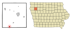 Location of Washta, Iowa | |
| Coordinates: 42°34′33″N 95°43′5″W | |
| Country | |
| State | |
| County | Cherokee |
| Area | |
| • Total | 1.04 sq mi (2.69 km2) |
| • Land | 1.04 sq mi (2.69 km2) |
| • Water | 0 sq mi (0 km2) |
| Elevation | 1,148 ft (350 m) |
| Population | |
| • Total | 248 |
| • Estimate (2016)[3] | 237 |
| • Density | 239/sq mi (92.1/km2) |
| Time zone | UTC-6 (Central (CST)) |
| • Summer (DST) | UTC-5 (CDT) |
| ZIP code | 51061 |
| Area code(s) | 712 |
| FIPS code | 19-82380 |
| GNIS feature ID | 0462723 |
Washta's name dates back to 1868 when a local man named Whisman turned his farm into a trading post/mail stop for the freight train going from Correctionville, Iowa to Cherokee, Iowa. He was asked to be the official postmaster for the area. When asked what the name of his town would be, he recalled an interesting encounter with two Native Americans the year before. While Whisman was out hunting, the two came upon him, removed his gun, looked at it, and handed it back while saying, "Wash-tay, Wash-tay," meaning good. Changing the pronunciation slightly, Whisman decided he would call the town Washta.[4]
Geography
Washta is located at 42°34′33″N 95°43′5″W (42.575896, -95.718051).[5] It is situated near the Little Sioux River.
According to the United States Census Bureau, the city has a total area of 1.04 square miles (2.69 km2), all land.[1]
Demographics
| Historical population | |||
|---|---|---|---|
| Census | Pop. | %± | |
| 1900 | 431 | — | |
| 1910 | 410 | −4.9% | |
| 1920 | 508 | 23.9% | |
| 1930 | 448 | −11.8% | |
| 1940 | 442 | −1.3% | |
| 1950 | 403 | −8.8% | |
| 1960 | 310 | −23.1% | |
| 1970 | 319 | 2.9% | |
| 1980 | 320 | 0.3% | |
| 1990 | 284 | −11.2% | |
| 2000 | 282 | −0.7% | |
| 2010 | 248 | −12.1% | |
| Est. 2016 | 237 | [3] | −4.4% |
| U.S. Decennial Census[6] | |||
2010 census
As of the census[2] of 2010, there were 248 people, 110 households, and 73 families residing in the city. The population density was 238.5 inhabitants per square mile (92.1/km2). There were 123 housing units at an average density of 118.3 per square mile (45.7/km2). The racial makeup of the city was 99.2% White, 0.4% Asian, and 0.4% from two or more races. Hispanic or Latino of any race were 2.4% of the population.
There were 110 households of which 26.4% had children under the age of 18 living with them, 50.9% were married couples living together, 11.8% had a female householder with no husband present, 3.6% had a male householder with no wife present, and 33.6% were non-families. 30.0% of all households were made up of individuals and 20% had someone living alone who was 65 years of age or older. The average household size was 2.25 and the average family size was 2.77.
The median age in the city was 45.8 years. 21.4% of residents were under the age of 18; 6.7% were between the ages of 18 and 24; 19.2% were from 25 to 44; 28.6% were from 45 to 64; and 23.8% were 65 years of age or older. The gender makeup of the city was 47.2% male and 52.8% female.
2000 census
As of the census[7] of 2000, there were 282 people, 117 households, and 69 families residing in the city. The population density was 268.5 people per square mile (103.7/km²). There were 133 housing units at an average density of 126.6 per square mile (48.9/km²). The racial makeup of the city was 100.00% White. Hispanic or Latino of any race were 0.71% of the population.
There were 117 households out of which 28.2% had children under the age of 18 living with them, 47.9% were married couples living together, 6.0% had a female householder with no husband present, and 40.2% were non-families. 33.3% of all households were made up of individuals and 16.2% had someone living alone who was 65 years of age or older. The average household size was 2.41 and the average family size was 3.14.
In the city, the population was spread out with 26.2% under the age of 18, 7.4% from 18 to 24, 23.8% from 25 to 44, 24.8% from 45 to 64, and 17.7% who were 65 years of age or older. The median age was 38 years. For every 100 females, there were 94.5 males. For every 100 females age 18 and over, there were 96.2 males.
The median income for a household in the city was $30,673, and the median income for a family was $35,455. Males had a median income of $22,639 versus $18,750 for females. The per capita income for the city was $13,025. About 11.1% of families and 13.6% of the population were below the poverty line, including 22.8% of those under the age of eighteen and 6.3% of those sixty five or over.
Education
The River Valley Community School District operates public schools serving the community.[8] It was established on July 1, 1996 by the merger of the Eastwood Community School District and the Willow Community School District.[9]
References
- "US Gazetteer files 2010". United States Census Bureau. Retrieved 2012-05-11.
- "U.S. Census website". United States Census Bureau. Retrieved 2012-05-11.
- "Population and Housing Unit Estimates". Retrieved June 9, 2017.
- http://www.cherokeecountyiowa.com/Towns/Washta.htm
- "US Gazetteer files: 2010, 2000, and 1990". United States Census Bureau. 2011-02-12. Retrieved 2011-04-23.
- "Census of Population and Housing". Census.gov. Retrieved June 4, 2015.
- "U.S. Census website". United States Census Bureau. Retrieved 2008-01-31.
- "River Valley" (PDF). Iowa Department of Education. Retrieved 2019-07-15.
- "REORGANIZATION & DISSOLUTION ACTIONS SINCE 1965-66" (PDF). Iowa Department of Education. 2018-06-19. Archived from the original (PDF) on 2018-06-19. Retrieved 2019-07-15.
Municipalities and communities of Cherokee County, Iowa, United States | ||
|---|---|---|
| Cities | Map of Iowa highlighting Cherokee County | |
| Townships | ||
| Unincorporated communities | ||