Huanacuni
Huanacuni[1][2] (possibly from Aymara wanaku, wanaqu guanaco)[3] is a mountain in the Apolobamba mountain range in the Bolivian Andes, about 5,796 metres (19,016 ft) high. It is situated in the La Paz Department, Franz Tamayo Province, Pelechuco Municipality, east of Cololo Lake and northwest of Qala Phusa (Cololo).[4]
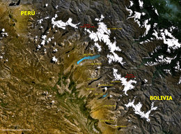
Map of the Apolobamba mountain range showing Cololo Lake. Wanakuni lies east of it and northwest of Qala Phusa (Cololo).
| Wanakuni | |
|---|---|
 Wanakuni Location in Bolivia | |
| Highest point | |
| Elevation | 5,796 m (19,016 ft) [1] |
| Coordinates | 14°51′S 69°10′W [2] |
| Geography | |
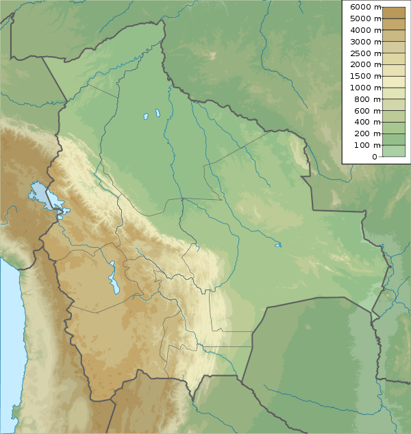
| Location | Bolivia, La Paz Department, Franz Tamayo Province |
| Parent range | Andes, Apolobamba mountain range |
References
- "Huanacuni". andes.org.uk. Retrieved 2012-11-30.
- "Nevado Huanacuni". mapcarta.com. Retrieved 2012-11-30.
- Radio San Gabriel, "Instituto Radiofonico de Promoción Aymara" (IRPA) 1993, Republicado por Instituto de las Lenguas y Literaturas Andinas-Amazónicas (ILLLA-A) 2011, Transcripción del Vocabulario de la Lengua Aymara, P. Ludovico Bertonio 1612 (Spanish-Aymara-Aymara-Spanish dictionary)
- John Biggar, Los Andes - Una Guía para Escaladores, p. 130: Map
This article is issued from Wikipedia. The text is licensed under Creative Commons - Attribution - Sharealike. Additional terms may apply for the media files.