Walnut, Mississippi
Walnut is a town in Tippah County, Mississippi, United States. The population was 771 at the 2010 census.
Walnut, Mississippi | |
|---|---|
 Walnut | |
 Location of Walnut, Mississippi | |
 Walnut, Mississippi Location in the United States | |
| Coordinates: 34°56′57″N 88°54′35″W | |
| Country | United States |
| State | Mississippi |
| County | Tippah |
| Area | |
| • Total | 5.45 sq mi (14.12 km2) |
| • Land | 5.43 sq mi (14.06 km2) |
| • Water | 0.02 sq mi (0.06 km2) |
| Elevation | 459 ft (140 m) |
| Population (2010) | |
| • Total | 771 |
| • Estimate (2018)[2] | 754 |
| • Density | 138.91/sq mi (53.64/km2) |
| Time zone | UTC-6 (Central (CST)) |
| • Summer (DST) | UTC-5 (CDT) |
| ZIP code | 38683 |
| Area code(s) | 662 Exchange: 223 |
| FIPS code | 28-77480 |
| GNIS feature ID | 0695090 |
| Website | www |
History
Walnut was established in 1872 on land belonging to Henry Hopkins, an early settler. The town was initially known as "Hopkins," but was changed to "Walnut" in 1876.[3]
Geography
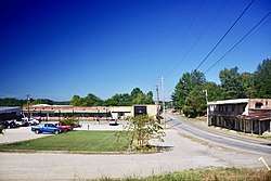
Walnut is located at 34°56′57″N 88°54′35″W (34.949109, -88.909812).[4] The town lies west of Corinth at the intersection of U.S. Route 72 and Mississippi Highway 15. The town's older business district is concentrated along Mississippi Highway 354, just east of its intersection with MS 15. The town lies just a few miles south of the Mississippi-Tennessee state line, and is located roughly equidistant between Memphis and The Shoals in Alabama.
According to the United States Census Bureau, the town has a total area of 5.4 square miles (14 km2), of which 5.4 square miles (14 km2) is land and 0.04-square-mile (0.10 km2) (0.37%) is water.
Demographics
| Historical population | |||
|---|---|---|---|
| Census | Pop. | %± | |
| 1920 | 150 | — | |
| 1930 | 219 | 46.0% | |
| 1940 | 516 | 135.6% | |
| 1950 | 481 | −6.8% | |
| 1960 | 390 | −18.9% | |
| 1970 | 458 | 17.4% | |
| 1980 | 513 | 12.0% | |
| 1990 | 523 | 1.9% | |
| 2000 | 754 | 44.2% | |
| 2010 | 771 | 2.3% | |
| Est. 2018 | 754 | [2] | −2.2% |
| U.S. Decennial Census[5] | |||
As of the census[6] of 2000, there were 754 people, 319 households, and 202 families residing in the town. The population density was 139.1 people per square mile (53.7/km²). There were 341 housing units at an average density of 62.9 per square mile (24.3/km²). The racial makeup of the town was 84.48% White, 14.46% African American, 0.27% Native American, 0.13% from other races, and 0.66% from two or more races. Hispanic or Latino of any race were 0.66% of the population.
There were 319 households out of which 30.4% had children under the age of 18 living with them, 45.1% were married couples living together, 14.4% had a female householder with no husband present, and 36.4% were non-families. 35.1% of all households were made up of individuals and 19.4% had someone living alone who was 65 years of age or older. The average household size was 2.36 and the average family size was 3.06.
In the town, the population was spread out with 26.9% under the age of 18, 10.6% from 18 to 24, 25.7% from 25 to 44, 19.5% from 45 to 64, and 17.2% who were 65 years of age or older. The median age was 36 years. For every 100 females, there were 81.7 males. For every 100 females age 18 and over, there were 78.9 males.
The median income for a household in the town was $17,102, and the median income for a family was $23,906. Males had a median income of $29,444 versus $17,292 for females. The per capita income for the town was $10,212. About 25.1% of families and 26.4% of the population were below the poverty line, including 25.4% of those under age 18 and 40.8% of those age 65 or over.
Education
The Town of Walnut is served by the North Tippah School District.
Media
WLRC 850 on the AM dial is a Daytime-only station serving Walnut and the surrounding area with a Gospel music format.
References
- "2017 U.S. Gazetteer Files". United States Census Bureau. Retrieved Jan 6, 2019.
- "Population and Housing Unit Estimates". Retrieved March 1, 2020.
- Town and County History, Walnut official website. Accessed: 24 September 2018.
- "US Gazetteer files: 2010, 2000, and 1990". United States Census Bureau. 2011-02-12. Retrieved 2011-04-23.
- "Census of Population and Housing". Census.gov. Retrieved June 4, 2015.
- "U.S. Census website". United States Census Bureau. Retrieved 2008-01-31.
External links

| Authority control |
|
|---|