Waini River
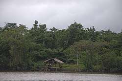
The Waini River is a river in the Barima-Waini region of northern Guyana. It flows into the Atlantic Ocean near the border with Venezuela. The upper portion of the river flows through the Guianian moist forests, while the lower Waini river flows through the eastern extent of the vast Orinoco Delta swamp forests before emptying into the sea.
| Waini River | |
|---|---|
 | |
| Location | |
| Country | Guyana[1] |
| Region | Barima-Waini |
| Physical characteristics | |
| Source | |
| • location | [1][2] |
| • coordinates | 7.0°N 59.4°W |
| Mouth | |
• location | Waini Point[1][3] |
• coordinates | 8.390186°N 59.837208°W |
• elevation | Sea level[1] |
| Basin features | |
| Tributaries | |
| • left | "Left" is in the sense source to mouth but tributaries are listed mouth to source[1] Mora Passage Unnamed Warapoko Unnamed Sabaina River Arasika Unnamed Unnamed Barama River (Village of Santa Cruz) Kumanaballi Matorohana Anaida Arawatta Unnamed Ananu Two Mouth Ariaparu Pelibelimba Turubang Yamira Durabanna Imotai Unnamed Waterfall Kasipang Unnamed Waterfall Waterfall Unnamed Unnamed Unnamed Unnamed Source of Waini River. |
| • right | "Right" is in the sense source to mouth but tributaries are listed mouth to source[1][4] Thunder Creek Unnamed Kuberina Mokaboina Luri Baramanni Barukabaru Kumaruwa Unnamed Kuniaballi Unnamed (Village of Santa Cruz) Unnamed Unnamed Sirikata River Kuiaru River Mubohina River Unnamed Unnamed Kwabanna Unnamed Unnamed Kwassi Anapari Akabaru Unnamed Mariwaru Urabubaru Potawau Turtle Unnamed Shararin Waterfall Waterfall Unnamed Unnamed Waterfall Unnamed Arawapai Unnamed Unnamed Unnamed Unnamed Unnamed Source of Waini River. |
Almond Beach at the mouth of the Waini River is one of the most important nesting areas for four of the seven species of marine turtles in the world. It is the only place in Guyana that has a large stretch of intact mangrove forest, brackish water and coastal swamp communities.
Waterfalls
There are three significant waterfalls along the Waini.[1] The furthest up river is Kasatu Falls at 7.22366°N 59.3591°W.[5][6]
Riverside communities
- Santa Cruz[1]
- Santa Rosa, an Amerindian community
See also
References
- UK Directorate of Overseas Surveys 1:500,000 map of Guyana NW sheet, 1966.
- "Source of Waini River". Wikimapia. Retrieved 9 December 2014.
- "Mouth of Waini River". Wikimapia. Retrieved 9 December 2014.
- UK Directorate of Overseas Surveys 1:500,000 map of Guyana NE sheet, 1972.
- "Waterfalls of Guyana - the list". wondermondo.com.
- "Kasatu Fall Longitude and Latitude - All About Countries". allaboutcountries.com.
This article is issued from Wikipedia. The text is licensed under Creative Commons - Attribution - Sharealike. Additional terms may apply for the media files.