Vromos Island
Vromos Island (Bulgarian: остров Вромос, romanized: ostrov Vromos, IPA: [ˈɔstrov vroˈmɔs]) is a rocky island 600 m long in east-west direction and 260 m wide lying in Perrier Bay on the northwest coast of Anvers Island in the Palmer Archipelago, Antarctica. It is separated from Trebishte Island to the south by a 300 m wide passage.
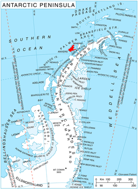 Location of Anvers Island in the Antarctic Peninsula region. | |
| Geography | |
|---|---|
| Location | Antarctica |
| Coordinates | 64°24′55″S 63°41′36″W |
| Archipelago | Palmer Archipelago |
| Administration | |
| Administered under the Antarctic Treaty System | |
| Demographics | |
| Population | 0 |
The island is named after Vromos Bay on the Bulgarian Black Sea Coast.
Location
Vromos Island is located at 64°24′55″S 63°41′36″W, 5.07 km east-northeast of Giard Point, 5.21 km south of Masteyra Island and 11.45 km south of Quinton Point. British mapping in 1980.
Maps
- British Antarctic Territory. Scale 1:200000 topographic map. DOS 610 Series, Sheet W 64 62. Directorate of Overseas Surveys, UK, 1980.
- Antarctic Digital Database (ADD). Scale 1:250000 topographic map of Antarctica. Scientific Committee on Antarctic Research (SCAR). Since 1993, regularly upgraded and updated.
References
- Bulgarian Antarctic Gazetteer. Antarctic Place-names Commission. (details in Bulgarian, basic data in English)
- Vromos Island. SCAR Composite Antarctic Gazetteer.
External links
- Vromos Island. Copernix satellite image
This article includes information from the Antarctic Place-names Commission of Bulgaria which is used with permission.
This article is issued from Wikipedia. The text is licensed under Creative Commons - Attribution - Sharealike. Additional terms may apply for the media files.