Volcanology of Java
The Indonesian island of Java is almost entirely of volcanic origin, and contains numerous volcanoes, 45 of which are considered active volcanoes. As is the case for many other Indonesian islands, volcanoes have played a vital role in the geological and human history of Java. Indeed, land is created on Java as a result of lava flows, ash deposits, and mud flows (lahars). Volcanoes are a major contributor to the immense fertility of Java, as natural erosion transports volcanic material as alluvium to the island's plains, forming thick layers of fertile sediment. The benefit is not just in the immediate vicinity of the volcano, with fine ash emitted from eruptions being dispersed over wide areas.

Climbing volcanoes (and other mountains) is increasingly popular.
List of volcanoes
This list is of volcanoes from the west of Java to the east. Local terminology and usage has the word Gunung (mount or mountain) precede the names.
West Java
- Pulosari Stratovolcano
- Gunung Karang Stratovolcano
- Kiaraberes-Gagak Stratovolcano
- Perbakti Stratovolcano
- Mount Salak Stratovolcano
- Mount Gede Stratovolcano
- Mount Pangrango Stratovolcano
- Mount Patuha Stratovolcano
- Wayang-Windu Lava dome
- Mount Malabar Stratovolcano
- Tangkuban Parahu Stratovolcano
- Mount Papandayan Stratovolcanoes
- Mount Kendang Stratovolcano
- Kamojang Stratovolcanoes
- Mount Guntur Complex volcano
- Mount Tampomas Stratovolcano
- Galunggung Stratovolcano
- Talagabodas Stratovolcano
- Karaha Crater Fumarole field
- Mount Cereme Stratovolcano
Central Java
- Mount Slamet Stratovolcano
- Dieng Volcanic Complex Complex volcano
- Mount Sundoro Stratovolcano
- Mount Sumbing Stratovolcano
- Mount Ungaran Stratovolcano
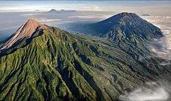
- Mount Telomoyo Stratovolcano
- Mount Merbabu Stratovolcano
- Mount Merapi Stratovolcano
- Mount Muria Stratovolcano
- Mount Lawu Stratovolcano (bordering with East Java)
East Java
- Mount Lawu Stratovolcano (bordering with Central Java)
- Mount Wilis Stratovolcano
- Kelut Stratovolcano
- Kawi-Butak Stratovolcanoes
- Arjuno-Welirang Stratovolcano
- Penanggungan Stratovolcano
- Malang Plain Maars
- Semeru Stratovolcano
- Mount Bromo
- Lamongan Stratovolcano
- Mount Lurus
- Iyang-Argapura Complex volcano
- Raung Stratovolcano
- Ijen Stratovolcanoes
- Baluran Stratovolcano
List of active volcanoes
References
- "Mount Merapi Erupts". ANTARA. 26 October 2010. Retrieved 2010-10-27.
- Whitten, T, Soaeriaatmadja, R. E., Afiff, S. A., (editors), The Ecology of Java and Bali, Periplus Editions (HK) Ltd. 1996, Hardcover, 969 pages, ISBN 962-593-072-8