Utah State Route 127
State Route 127 is a state highway in the state of Utah that spans 2.507 miles (4.035 km) within Syracuse in Davis County.
| ||||
|---|---|---|---|---|
| 1700 South | ||||
| Route information | ||||
| Defined by Utah Code §72-4-118 | ||||
| Maintained by UDOT | ||||
| Length | 2.507 mi[1] (4.035 km) | |||
| Existed | 1965–present | |||
| Major junctions | ||||
| West end | ||||
| East end | ||||
| Highway system | ||||
| ||||

Route description
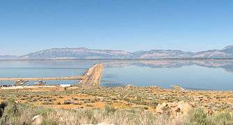
The western terminus of the route is at the intersection of SR-110 (4500 West) and 1700 South (west of SR-127, 1700 South becomes the Davis County Causeway, a causeway over the Great Salt Lake that provides access to Antelope Island). The route continues east until it ends at SR-108 (2000 West), while 1700 South continues east along SR-108.
History
The part of 1700 South east of 2000 West in Syracuse was added to the state highway system in 1931 as SR-108, a designation it still carries.[2] From 2000 West to 4500 West, the road became a state highway in 1935, but with a different number - SR-195 (which turned north on 4500 West to Hooper).[3] The entire length of SR-195 was removed from the state highway system in 1947,[4] but was re-added in the 1960s. A new State Route 127 was designated in 1965, following the 1700 South portion of former SR-195 and continuing west to the north end of Antelope Island via the Antelope Island Causeway;[5] 4500 West was restored in 1969 as a new SR-110.[6] The causeway was closed in June 1983 due to high water in the Great Salt Lake,[7] and in 1991 the state legislature passed a law to fund a reconstruction through the Utah Division of Parks and Recreation. The Utah Transportation Commission gave the causeway to Davis County that year to make it possible for a toll to be charged, leaving SR-127 running only from SR-110 east to SR-108.[5] The new causeway opened in July 1993, ten years after the old one had been closed.[7]
Major intersections
The entire route is in Syracuse, Davis County.
| mi[1] | km | Destinations | Notes | ||
|---|---|---|---|---|---|
| 0.000 | 0.000 | Western terminus | |||
| 2.507 | 4.035 | Eastern terminus | |||
| 1.000 mi = 1.609 km; 1.000 km = 0.621 mi | |||||
References
- "State Route 127 Highway reference". Utah Department of Transportation. Retrieved 2008-07-07.
- Utah State Legislature (1931). "Chapter 55: Designation of State Roads". Session Laws of Utah.
(108) From route 1 south of Clearfield westerly to Syracuse.
- Utah State Legislature (1935). "Chapter 37: Designation of State Roads". Session Laws of Utah.
Route 195. From Hooper on route 37 southerly to Syracuse.
- Utah State Legislature (1947). "Chapter 49". Session Laws of Utah.
- Utah Department of Transportation, Highway Resolutions: "Route 127". (774 KB), updated November 2007, accessed May 2008
- Utah Department of Transportation, State Route History Archived 2007-02-25 at the Wayback Machine, accessed July 2007
- Craig Hansell, Salt Lake Tribune, 2,000 Acres of Antelope Island Will Open, June 30, 1993, p. D1