Ustyurt Plateau
The Ustyurt or Ust-Yurt (Russian: Устюрт; Kazakh: Үстірт; Turkmen: Üstyurt) is a transboundary clay desert shared by Turkmenistan, Uzbekistan and Kazakhstan.[1]
| Ustyurt | |
|---|---|
| Устюрт / Үстірт | |
.jpg) Ustyurt desert road | |
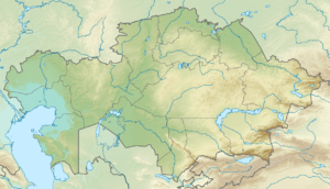 Location in Kazakhstan | |
| Location | Kazakhstan / Turkmenistan / Uzbekistan |
| Coordinates | 43°17′N 55°33′E |
| Elevation | 160 meters (520 ft) to 200 meters (660 ft) |
| Area | 200,000 km2 (77,000 sq mi) |
The plateau's semi-nomadic human population raises sheep, goats, and camels.
Geography
The Ustyurt is located between the Dead Kultuk, Mangyshlak Peninsula and Kara-Bogaz-Gol of the Caspian Sea to the west, and the Aral Sea, Amudarya Delta and Sarygamysh Lake to the east.
It extends roughly 200,000 km2 (77,000 sq mi), with an average altitude of 150 m (490 ft). Its highest point rises to 370 m (1,200 ft) in the south-west.[2] At its northeastern edge it drops steeply to the Aral Sea and the surrounding plain.
Protected areas
Kazakhstan created the Ustyurt Nature Reserve (223,300 hectares) in July, 1984 in the south of Mangystausky district in Eralievsky region.[3] It preserves rare fauna and flora such as the Ustyurt Mountain sheep and the Saiga antelope.[4] Among its features are Sherkala Mountain and the concretions found in the Torysh ('Valley of Balls') near the town of Shetpe.
See also
- Emba River
- Transcaspian Region
- Karakalpaks
- Khwarezm oasis region
References
- Gritsina, M. (2019). "The Caracal Caracal caracal Schreber, 1776 (Mammalia: Carnivora: Felidae) in Uzbekistan". Journal of Threatened Taxa. 11 (4): 13470–13477. doi:10.11609/jott.4375.11.4.13470-13477.
- "The Ustyurt Plateau" (PDF). USAID. Retrieved 15 August 2016.
- "Ustyurtsky state natural reserve". Welcome to Kazakhstan. Silk Tour agency. Retrieved 16 August 2016.
- "Ustyurt Nature Reserve, Kazakhstan". Advantour. Retrieved 16 August 2016.
External links

- Hundreds of desert kites in the Ustyurt. Nat. Geographic