U.S. Route 79 in Kentucky
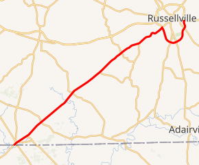
U.S. Route 79 (US 79) enters Kentucky from Tennessee in Todd County west of Guthrie and runs northeast into Logan County, terminating at a junction with US 68, US 68 Business, and Kentucky Route 80 (KY 80) in Russellville. US 79 remains a two-lane road throughout Kentucky.
| ||||
|---|---|---|---|---|
US 79 highlighted in red | ||||
| Route information | ||||
| Maintained by KYTC | ||||
| Length | 26.80 mi[1][2] (43.13 km) | |||
| Major junctions | ||||
| South end | ||||
| ||||
| North end | ||||
| Location | ||||
| Counties | Todd, Logan | |||
| Highway system | ||||
| ||||

Route description
US 79 in Kentucky begins at the Tennessee state line west of Guthrie and travels northeast, forming a junction with US 41 0.497 miles (0.800 km) from the state line. The route continues to the northeast, passing north of Guthrie and Allensville in rural areas of Todd County. 10.606 miles (17.069 km) from the Kentucky-Tennessee border, US 79 crosses into Logan County where it becomes known as Clarksville Road. The route continues northeast through rural areas of Logan County until it comes to an intersection with US 431, the Russellville Bypass, on the south side of Russellville 10.713 miles (17.241 km) from the Todd County line. US 79 and US 431 run concurrently along the Bypass south of town where it intersects KY 96 and the concurrency ending at Nashville Road (US 431 continues south while KY 2146 begins and heads north). US 79 and the Bypass begin to curve back north where it intersects KY 100 at its western terminus (KY 100 formerly continued along the Bypass to US 79's current terminus). US 79 ends at an intersection with Bowling Green Road which carries US 68 and KY 80 to the east and US 68 Bus. to the west towards downtown Russellville.[3][4]
History

The current route in Kentucky was paved by 1939 but was not signed as US 79. The highway was originally designated as Kentucky Route 105. KY 105 originally ran the current designations of US Route 79 and Kentucky Route 79, from the state line to Russellville to the Rough River Lake State Resort Park area, and ending with KY 105's current alignment.[5] By 1958, the current route was signed as US 79, although, it extended a bit further northeast into Russellville.[6] Its long-time northern terminus at US 431 was created by 1999 with the construction of the Russellville Bypass.[7]
In November 2017, US 79's northern terminus returned to the east side of Russellville when it was routed onto the southern section of the Russellville Bypass loop when it was completed.[8]
Major intersections
| County | Location | mi[2] | km | Destinations | Notes |
|---|---|---|---|---|---|
| Todd | | 0.00 | 0.00 | Tennessee state line | |
| Guthrie | 0.28 | 0.45 | |||
| 0.50 | 0.80 | ||||
| 1.86 | 2.99 | ||||
| | 3.97 | 6.39 | |||
| | 8.79 | 14.15 | |||
| Logan | | 12.57 | 20.23 | ||
| Old Volney | 14.08 | 22.66 | |||
| | 15.79 | 25.41 | South end of KY 1151 overlap | ||
| | 15.83 | 25.48 | North end of KY 1151 overlap | ||
| Cave Springs | 17.96 | 28.90 | |||
| Russellville | 21.32 | 34.31 | Western terminus of KY 3240 (former US 79); western end of US 431 concurrency | ||
| | 23.29 | 37.48 | |||
| | 23.94 | 38.53 | eastern end of US 431 concurrency; southern terminus of KY-2146 | ||
| | 26.13 | 42.05 | Western terminus of KY 100 since 2017 | ||
| Russellville | 26.80 | 43.13 | Northern terminus of US 79; Russellville Bypass continues straight ahead | ||
1.000 mi = 1.609 km; 1.000 km = 0.621 mi
| |||||
References
- "Kentucky Transportation Cabinet - Division of Planning". Kentucky Transportation Cabinet (KYTC). Retrieved July 22, 2014.
- "Active Highway Plan". KYTC. Retrieved November 19, 2017.
- Google (November 19, 2017). "US 79 (from Tennessee to US 431)" (Map). Google Maps. Google. Retrieved November 19, 2017.
- Google (November 19, 2017). "US 79 (from US 431 to US 68)" (Map). Google Maps. Google. Retrieved November 19, 2017.
- Kentucky (PDF) (Map) (1939 ed.). 1 inch:12 miles. Cartography by State-wide Highway Planning Survey. Kentucky State Highway Department. 1939. Retrieved July 22, 2014.
- Logan County (PDF) (Map) (1958 ed.). 1 inch:125000 feet. Cartography by State-wide Highway Planning Survey. Kentucky State Highway Department. 1958. Retrieved July 22, 2014.
- Kentucky (PDF) (Map) (1999 ed.). 1 inch:12 miles. Cartography by State-wide Highway Planning Survey. Kentucky State Highway Department. 1999. Retrieved July 22, 2014.
- French, Jackson (November 8, 2017. “Section of Russellville bypass opens, completes loop around city”. Bowling Green Daily News. Retrieved November 18, 2017.