Tunney's Pasture
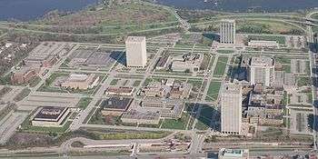
Tunney's Pasture is a 49-hectare (121-acre) campus in Ottawa, Ontario, Canada that is exclusively developed for federal government buildings. It is bordered by Scott Street to the south, Parkdale Avenue to the east, the Sir John A. Macdonald Parkway to the north, and Northwestern Avenue to the west. While strictly speaking it is confined to this area, people living in the vicinity of it will often call the wider neighbourhood Tunney's Pasture.
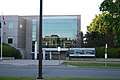
The complex is served by Tunney's Pasture station, a stop on the Transitway bus rapid transit system and the western terminus on the Confederation Line of Ottawa's O-Train light rail system.
History
Before development in the early 1950s, this area was officially known as Lot 35, Concession A, Township of Nepean, and, as the name still indicates, it was used as a farmer's pasture and named after Anthony Tunney who pastured his cows on the empty land.[1]
As a young man, Anthony Tunney emigrated from Ireland to Ottawa in 1867 and married and built a house at 201 Parkdale Avenue. The owner of the pasture, the Ottawa Lumber Merchants' Association, hired Tunney to be the caretaker of the land and allowed him to graze his cattle in the field. Although Tunney was able to claim ownership because he had been paying the taxes on the property, he never did so and the land was eventually sold by the association to the government.
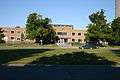
In 1950, the property became part of the Greber Plan that envisioned it as a government employment centre within a quiet and secure park-like campus. From the 1950s to the 1960s, 18 low-rise buildings were constructed with modern, classical-inspired architecture and similar materials, massing, and scale. Most of these combined research and office functionality under one roof. Starting in the 1970s however, new buildings and additions were built that deviatated from Gréber's vision, introducing high-rise office towers, new architectural styles, and cladding materials to the site.[2]
Little development took place in the 1990s, 2000s, and 2010s. By 2011, most buildings were considered outdated and the site under-used. So Public Works and Government Services Canada has initiated a plan to redevelop the campus with new high-rise buildings and mixed-use commercial and residential space over a 25-year period. In all, the plan aims to double the number of federal employees to 20,000 and add between 800 and 1000 residential units.[3][4]
List of buildings
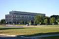
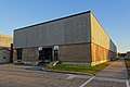
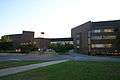
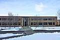
Various ministries and agencies occupy offices, in whole or in part, in Tunney's Pasture.[5][4]
| Image | Name | Building # | Address | Year built | Year demolished | Primary tenant | Floor area (m²) |
|---|---|---|---|---|---|---|---|
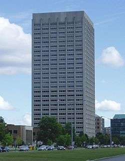 |
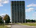
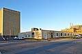
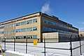
R. H. Coats Building | Building 1 | 100 Tunney's Pasture Driveway | Statistics Canada | |||
 |
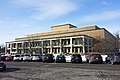
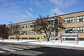
Main Building | Building 3 | 150 Tunney's Pasture Driveway | Statistics Canada | |||
 |
Jean Talon Building | Building 5 | 170 Tunney's Pasture Driveway | Statistics Canada | |||
 |
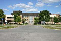
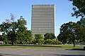
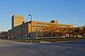
Brooke Claxton Building | Building 9 | 70 Columbine Driveway | Health Canada | |||
 |
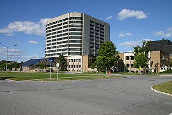
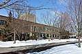
Jeanne Mance Building | Building 19 | 200 Eglantine Driveway | Health Canada | |||
 |
Laboratory Centre for Disease Control | Building 6 | 100 Eglantine Driveway | Health Canada | |||
 |
Health Protection Building | Building 7 | 200 Tunney's Pasture Driveway | Health Canada | |||
 |
Environmental Health Building | Building 8 | 50 Colombine Driveway | Health Canada | |||
 |
Animal Breeding Building | Building 12 | 100 Chardon Driveway | Health Canada | |||
 |
Sir Frederick G Banting Research Centre | Building 22 | 251 Sir Frederick Banting Driveway | Health Canada | |||
 |
Finance Building | Building 2 | 101 Tunney's Pasture Driveway | Health Canada | |||
 |
Occupational Health Unit Building | Building 17 | 51 Chardon Driveway | Health Canada | |||
| Virus Laboratory | Building 10 | Columbine Driveway | Health Canada | ||||
 |
General Records Centre | Building 15 | 130 Goldenrod Driveway | Library and Archives Canada | |||
 |
Personnel Records Centre | Building 18 | 161 Goldenrod Driveway | Library and Archives Canada | |||
 |
Standards Building | Building 4 | 151 Tunney's Pasture Driveway | Measurement Canada | |||
 |
National Defence Data Centre | Building 16 | 101 Goldenrod Driveway | Department of National Defence | |||
 |
Finance Annex | Building 14 | 100 Yarrow Driveway | Geological Survey of Canada | |||
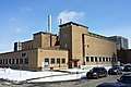 |
Central Heating and Cooling Plant | Building 13 | 50 Chardon Driveway | ||||
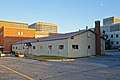 |
Butler Hut | Building 11 | 150 Chardon Driveway | ||||
| Atomic Energy of Canada Building | Building 20 | 20 Goldenrod Driveway | Atomic Energy of Canada Limited | ||||
| Eldorado Nuclear Building | Building 21 |
Notes
- Statistics Canada, 71
- "About Tunney's Pasture". Tunney's Pasture Master Plan. Public Works and Government Services Canada. 2012-08-17. Archived from the original on 2012-08-24. Retrieved 2012-08-20.
- Joanne Chianello (September 18, 2012). "Vision for Tunney's Pasture a clouded one". Ottawa Citizen. Retrieved 13 May 2014.
- "Tunney's Pasture buildings past their prime". CBC News. November 24, 2011. Retrieved 13 May 2014.
- "Tunney's Pasture". Directory of Federal Real Property. Treasury Board of Canada Secretariat. Retrieved 8 April 2015.
References
- Statistics Canada (1993). 75 Years and Counting: A History of Statistics Canada. Ottawa: Minister Responsible for Statistics Canada. (Statistics Canada Catalogue no. 11-531).
External links
| Wikimedia Commons has media related to Tunney's Pasture. |