Trnjanska Savica
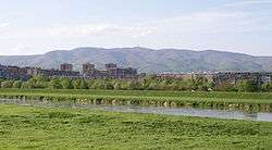
Savica or Trnjanska Savica is a neighbourhood of Zagreb, Croatia, located on the left (northern) bank of Sava river, west of Folnegovićevo naselje and east of Staro Trnje (Old Trnje). Part of the city district of Trnje, the neighbourhood covers an area of 76.8 hectares (190 acres) and, according to the 2011 census, it is inhabited by 8,449 people.[3][4]
Savica | |
|---|---|
| Trnjanska Savica | |
 | |
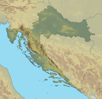 Savica Location of Savica in Croatia  Savica Savica (Europe) | |
| Coordinates: 45°49′N 15°59′E | |
| Country | |
| County | |
| Unified | 1999 |
| Area | |
| • Total | 0.768 km2 (0.297 sq mi) |
| Population | |
| • Total | 8,449 |
| Demonym(s) | Zagrepčanin (hr) Zagreber (en) Purger (informal, jargon) |
| Time zone | UTC+1 (CET) |
| • Summer (DST) | UTC+2 (CEST) |
| Postal code | HR-10 000, |
| Area code | +385 1 |
| Vehicle registration | ZG |
| Website | zagreb |
Savica was built according to the socialist model of a functional neighbourhood, which is planned to fulfill all day-to-day needs of its inhabitants. Construction of high-rise apartment buildings in Savica is still ongoing, mostly in the southeastern part of the neighbourhood.
The neighbourhood is served by the Jure Kaštelan Elementary School, Savica Farmer's Market, Savica Library and State Geodetic Directorate of Croatia, and belongs to the Parish of blessed Aloysius Stepinac.
Gallery
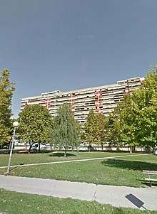
 The largest apartment building in Savica, known colloquially as the "officer's skyscraper"
 Savica Farmer's Market
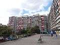
 Typical Savica architecture
- Park kraj Osnovne škole Jure Kaštelana na Savici
References
| Wikimedia Commons has media related to Savica, Zagreb. |
- "10. Mjesni odbor Trnjanska Savica". Zagreb.hr (in Croatian). City of Zagreb. Retrieved 25 May 2017.
- "Stanovništvo Grada Zagreba po mjesnim odborima, Popis 2011" (PDF). Zgizbori.hr (in Croatian). Retrieved 25 May 2017.
- "10. Mjesni odbor Trnjanska Savica". Zagreb.hr (in Croatian). City of Zagreb. Retrieved 25 May 2017.
- "Stanovništvo Grada Zagreba po mjesnim odborima, Popis 2011" (PDF). Zgizbori.hr (in Croatian). Retrieved 25 May 2017.