Trasierra/Tierras de Granadilla
Trasierra/Tierras de Granadilla (Extremaduran: Transierra - Granaílla), traditionally known as Tierras de Granadilla, is a comarca at the northern end of province of Cáceres in Extremadura, one of Spain's seventeen Autonomous Communities.
Trasierra/Tierras de Granadilla Transierra - Granaílla | |
|---|---|
Comarca | |
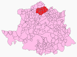 Location in the province of Cáceres. | |
| Country | |
| Autonomous community | Extremadura |
| Province | Cáceres |
| Municipalities | List
|
| Area | |
| • Total | 614.69 km2 (237.33 sq mi) |
| Population | |
| • Total | 10,298 |
| • Density | 17/km2 (43/sq mi) |
| Time zone | UTC+1 (CET) |
| • Summer (DST) | UTC+2 (CEST) |
| Largest municipality | Zarza de Granadilla |
Its origins as an administrative unit date back to the establishment of the House of Alba in the 15th century. Its historical capital was the town of Granadilla, now abandoned. Until 1833 the Tierras de Granadilla historical region the five towns of las Hurdes, the villages of La Alberca and Sotoserrano (now in Salamanca Province, Castile and León), as well as the western part of Aldeanueva del Camino, which is now part of the Valle de Ambroz comarca to the east. The southern limit of Tierras de Granadilla is marked by the ancient commercial path known as "Via de la Plata", which is known locally as "lindón".[1]
There are linguistic affinities between this comarca and neighboring Las Hurdes and Sierra de Gata comarcas.[2]
The Mancomunidad Integral de Trasierra-Tierras de Granadilla was formed in 1997.[3] The Mancomunidad includes villages that were not part of the historical region, like Oliva de Plasencia, Jarilla and Cabezabellosa. Casar de Palomero town was merged with the Mancomunidad de las Hurdes.
Municipalities
The traditional names of the towns and aldeas are in brackets.
- Abadía
- Ahigal (L'Ahigal)
- Azabal (L'Azabal)
- El Bronco (El Broncu)
- Casar de Palomero (El Casal de Palomeru)
- Cerezo (Cerezu)
- Granadilla (Granaílla), now uninhabited.
- La Granja
- Guijo de Granadilla (El Guiju)
- Marchagaz
- Mohedas de Granadilla (Las Muedas)
- Palomero (Palomeru)
- Pedro-Muñoz (Peroti)
- La Pesga (La Peja)
- Rivera Oveja
- Santa Cruz de Paniagua (Santa Cruz de las Cebollas)
- Santibáñez el Bajo (Santibañis)
- Zarza de Granadilla (La Zarza)
References
- Martínez Diez, Gonzalo. Extremadura - Origen del nombre y formación de las dos provincias - Anuario de la Facultad de Derecho,2 - Universidad de Extremadura. Cáceres, 1983
- Interferencias lingüísticas y culturales en El Rebollar y otras partes (VI Coloquio de PROHEMIO)
- "Web de la Mancomunidad Integral Transierra-tierras de Granadilla". Archived from the original on 2009-02-07. Retrieved 2009-01-29.
- Diario Oficial de Extremadura
- Merchan Vega, Pilar. "Las tierras de Granadilla", Diputación Provincial, Institución Cultural El Brocense, 1998, Cáceres. 31x25. Recorrido etnográfico sobre la comarca.
- Luque Castilla, Carmen - "Tierras de Granadilla - Sorpresa Creciente" - Senderos de Extremadura, 17 - ALEXTUR - Noviembre-Enero 2003.
External links
- Web de la Asociación de Turismo de las Tierras de Granadilla
- Web de la Asociación de Desarrollo Cáparra
Comarcas of Extremadura | ||
|---|---|---|
| ||