Lake Topozero
Lake Topozero (Russian: Топозеро, Finnish: Tuoppajärvi) is a large freshwater lake in the Republic of Karelia, northwestern part of Russia. It has an area of 986 square kilometres (381 sq mi) long, and a drainage basin of 3,530 square kilometres (1,360 sq mi).[1] It is 75.3 km long and 30.3 km wide. Maximum depth is about 50 m. There are more than 100 islands on the lake. Topozero is used for fishery and timber rafting. Its primary outlfow is the Kovda, which is also called Sofyanga in its first stretch from Lake Topozero to Lake Pyaozero. The Kovda flows to the White Sea.
| Lake Topozero | |
|---|---|
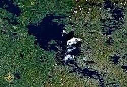 from space | |
 Lake Topozero | |
| Location | Republic of Karelia |
| Coordinates | 65°40′N 32°00′E |
| Primary outflows | Kovda (Sofyanga) |
| Basin countries | Russia |
| Max. length | 75.3 km (46.8 mi) |
| Max. width | 30.3 km (18.8 mi) |
| Surface area | 986 km2 (381 sq mi) |
| Max. depth | 50 m (160 ft) |
| Islands | 100+ |
This article is issued from Wikipedia. The text is licensed under Creative Commons - Attribution - Sharealike. Additional terms may apply for the media files.