Tocqueville-sur-Eu
Tocqueville-sur-Eu is a former commune in the Seine-Maritime department in the Normandy region in northern France. On 1 January 2016, it was merged into the new commune of Petit-Caux.[1]
Tocqueville-sur-Eu | |
|---|---|
Part of Petit-Caux | |
Location of Tocqueville-sur-Eu 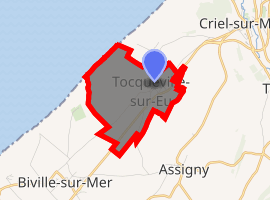
| |
 Tocqueville-sur-Eu  Tocqueville-sur-Eu | |
| Coordinates: 50°00′13″N 1°17′04″E | |
| Country | France |
| Region | Normandy |
| Department | Seine-Maritime |
| Arrondissement | Dieppe |
| Canton | Dieppe-2 |
| Commune | Petit-Caux |
| Area 1 | 3.6 km2 (1.4 sq mi) |
| Population (2006) | 191 |
| • Density | 53/km2 (140/sq mi) |
| Time zone | UTC+01:00 (CET) |
| • Summer (DST) | UTC+02:00 (CEST) |
| Postal code | 76910 |
| Elevation | 0–97 m (0–318 ft) (avg. 82 m or 269 ft) |
| 1 French Land Register data, which excludes lakes, ponds, glaciers > 1 km2 (0.386 sq mi or 247 acres) and river estuaries. | |
Geography
A small farming village situated in the Pays de Caux and on the coast of the English Channel, some 12 miles (19 km) northeast of Dieppe on the D925 road. Here, huge chalk cliffs rise up from the pebble beach.
Population
| 1962 | 1968 | 1975 | 1982 | 1990 | 1999 | 2006 |
|---|---|---|---|---|---|---|
| 127 | 143 | 135 | 146 | 156 | 153 | 191 |
| Starting in 1962: Population without duplicates | ||||||
Places of interest
- Trinity church, with vestiges dating from the twelfth century.
References
- Arrêté préfectoral 26 November 2015 (in French)
| Wikimedia Commons has media related to Tocqueville-sur-Eu. |
| Authority control |
|
|---|
This article is issued from Wikipedia. The text is licensed under Creative Commons - Attribution - Sharealike. Additional terms may apply for the media files.