Thyra (river)
The Thyra is a 20-kilometre (12 mi) long river of Saxony-Anhalt, Germany, in the district of Mansfeld-Südharz in the Harz Mountains.
| Thyra | |
|---|---|
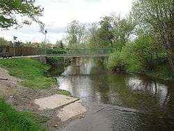 The Thyra in Berga | |
| Location | |
| Location | between Stolberg and Berga in Mansfeld-Südharz, Saxony-Anhalt, |
| Physical characteristics | |
| Source | |
| ⁃ location | in Stolberg |
| ⁃ coordinates | 51°34′22″N 10°57′17″E |
| ⁃ elevation | 410 m |
| Mouth | |
⁃ location | in the Helme |
⁃ coordinates | 51°26′29″N 11°00′54″E |
⁃ elevation | 152 m above NN |
| Length | 20 km (12 mi) |
| Discharge | |
| ⁃ location | at Stolberg gauge |
| ⁃ average | 0.418 m3/s (14.8 cu ft/s)[1] |
| ⁃ minimum | Record low: 0.008 m3/s (0.28 cu ft/s)[1] (in 2003) Average low: 0.044 m3/s (1.6 cu ft/s)[1] |
| ⁃ maximum | Average high: 5.19 m3/s (183 cu ft/s)[1] Record high: 19.6 m3/s (690 cu ft/s)[1] (in 1955) |
| Basin features | |
| Progression | Helme→ Unstrut→ Saale→ Elbe→ North Sea |
| Landmarks | Villages: Südharz, Berga |
| Bridges | Thyra Viaduct |
| Navigable | no |
Course
The Thyra begins its course in the old quarter of Stolberg in the Harz Mountains at the confluence of three mountain streams - the Große Wilde, Kleine Wilde and Lude[2] - and then flows through Stolberg, where several streams join it, before heading south through a steep valley to Rottleberode. Here the Thyra valley becomes very wide, but near Uftrungen it narrows again. South of Uftrungen the Thyra leaves the Harz and enters the Goldene Aue, crossing Bösenrode and Berga, before this little river enters the Helme.
Influence
Several things are named after the Thyra, for example the Thyra thermal baths (Thyratherme) in Stolberg or the railway line known as the Thyraliesel.
See also
External links
| Wikimedia Commons has media related to Thyra. |
References
- Pegel: Stolberg at: hochwasservorhersage.sachsen-anhalt.de
- Harzlive - Thyra