Texas State Highway Spur 527
Spur 527 is an unsigned 0.863-mile (1.389 km) spur route in Midtown Houston in the U.S. state of Texas. The roadway is a freeway spur that feeds traffic from the Southwest Freeway (Interstate 69/U.S. Highway 59) into Downtown Houston.
| ||||
|---|---|---|---|---|
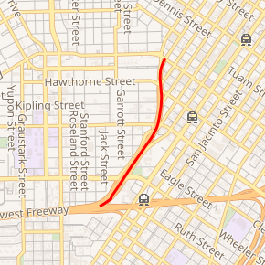
Spur 527 highlighted in red | ||||
| Route information | ||||
| Length | 0.863 mi[1] (1.389 km) | |||
| Existed | 1976–present | |||
| Major junctions | ||||
| South end | ||||
| North end | Elgin Street at Bagby Street and Brazos Street | |||
| Highway system | ||||
| ||||

History
On July 30, 1976, Spur 527 was designated as a spur of US 59 in Houston.[1] The freeway was the original routing of US 59 into downtown before being rerouted further east.[2] The freeway was built in the early 1960s as the overpasses at Richmond Avenue and Alabama Street had been completed by 1961.[3][4]
Route description
Spur 527 branches off I-69/US 59 on the west side of Midtown and heads northeast, feeding traffic into downtown. It provides access to Richmond Avenue and Travis Street before curving towards the north as it passes over Alabama Street. As it continues north through Midtown, the spur provides access to Louisiana Street before coming to an end at Elgin Street. The northbound lanes continue onto Brazos Street past Elgin Street and Bagby Street becomes the southbound lanes of Spur 527 after crossing Elgin Street.[5]
Exit list
The entire route is in Houston, Harris County. All exits are unnumbered.
| mi | km | Destinations | Notes | ||
|---|---|---|---|---|---|
| I-69/US 59 exit 127B northbound; southbound exit and northbound entrance. | |||||
| Richmond Avenue | Southbound entrance and northbound exit | ||||
| Travis Street | Northbound exit and southbound entrance | ||||
| Louisiana Street – Downtown | Northbound exit and southbound entrance | ||||
| Brazos Street | Southbound entrance only | ||||
| 1.000 mi = 1.609 km; 1.000 km = 0.621 mi | |||||
References
- Transportation Planning and Programming Division (n.d.). "State Highway Spur No. 527". Highway Designation Files. Texas Department of Transportation. Retrieved 2007-10-12.
- Houston road map (Map). Humble Oil. 1965. Retrieved 2008-03-05.
- "Richmond Avenue overpass". National Bridge Inventory. Retrieved 2008-03-05.
- "Alabama Street overpass". National Bridge Inventory. Retrieved 2008-03-05.
- Google (2008-03-04). "overview map of Spur 527" (Map). Google Maps. Google. Retrieved 2008-03-04.