Texas State Highway 208
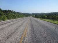
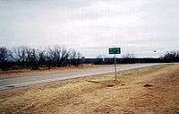
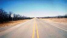
State Highway 208 or SH 208 is a Texas state highway that runs from San Angelo to southeast of Spur.
| ||||
|---|---|---|---|---|
 | ||||
| Route information | ||||
| Maintained by TxDOT | ||||
| Length | 145.194 mi[1] (233.667 km) Excludes length of all route overlaps | |||
| Existed | by 1935–present | |||
| Major junctions | ||||
| South end | ||||
| ||||
| North end | ||||
| Highway system | ||||
| ||||

History
The route was originally designated on July 16, 1934 from San Angelo to Robert Lee.[2] On June 16, 1936, SH 208 extended north to Colorado City.[3] The section from Robert Lee to Colorado City was dropped on March 26, 1942, but was reinstated on April 23, 1947, when it replaced RM 18. On February 23, 1956, the route was extended farther north to Snyder, replacing part of SH 101, and was signed (but not designated) to Spur along FM 1231 and FM 948. The extension to Spur was officially designated on August 29, 1990 to Spur, cancelling FM 1231 and FM 948.
FM 1231 was designated in 1949 as a route from US 84 at Snyder north 8.8 miles to a road intersection. In 1951, FM 1231 extended north to the Kent County Line. Later that year, FM 1231 extended 3 miles further north. In 1952, FM 1231 extended to US 380, replacing FM 1741 from US 380 south 6.1 miles. FM 1231 was cancelled in 1990 and transferred to SH 208.
Junction list
| County | Location | mi | km | Destinations | Notes |
|---|---|---|---|---|---|
| Tom Green | San Angelo | Southern terminus | |||
| | |||||
| Coke | | ||||
| | |||||
| Robert Lee | |||||
| | |||||
| | |||||
| Mitchell | | ||||
| | |||||
| Colorado City | |||||
| South end of I-20 overlap | |||||
| North end of I-20 overlap | |||||
| | |||||
| | |||||
| | |||||
| Scurry | | ||||
| | |||||
| Snyder | South end of Bus. US 84 overlap | ||||
| South end of US 180 overlap | |||||
| North end of US 180 overlap | |||||
| North end of Bus. US 84 overlap | |||||
| | |||||
| Kent | | South end of US 380 overlap | |||
| Clairemont | North end of US 380 overlap | ||||
| | |||||
| | |||||
| Dickens | | Northern terminus | |||
1.000 mi = 1.609 km; 1.000 km = 0.621 mi
| |||||
References
- Transportation Planning and Programming Division (n.d.). "State Highway No. 208". Highway Designation Files. Texas Department of Transportation. Retrieved January 31, 2016.
- (PDF) https://publicdocs.txdot.gov/minord/MinuteOrderDocLib/003673853.pdf. Missing or empty
|title=(help) - (PDF) https://publicdocs.txdot.gov/minord/MinuteOrderDocLib/003673885.pdf. Missing or empty
|title=(help)