Texas State Highway 156
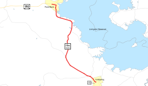
State Highway 156 (SH 156) is a short Texas state highway running between Coldspring and Point Blank. This route runs along the western side of Lake Livingston and mostly is within the Sam Houston National Forest. The route was designated on March 19, 1930 along its current route, replacing part of a branch of SH 45.
| ||||
|---|---|---|---|---|
 | ||||
| Route information | ||||
| Maintained by TxDOT | ||||
| Length | 14.233 mi[1] (22.906 km) | |||
| Existed | 1930–present | |||
| Major junctions | ||||
| South end | ||||
| North end | ||||
| Location | ||||
| Counties | San Jacinto | |||
| Highway system | ||||
| ||||

Junction list
The entire highway is in San Jacinto County.
| Location | mi[2] | km | Destinations | Notes | |
|---|---|---|---|---|---|
| Coldspring | 0.0 | 0.0 | |||
| Sam Houston National Forest | 1.0 | 1.6 | Southern terminus of FM 224 | ||
| 1.4 | 2.3 | Northern terminus of FM 945 | |||
| 5.2 | 8.4 | Southern terminus of FM 946 | |||
| Stephen Creek | 8.9 | 14.3 | Northern terminus of FM 224 | ||
| Point Blank | 14.3 | 23.0 | |||
| 1.000 mi = 1.609 km; 1.000 km = 0.621 mi | |||||
References
- Transportation Planning and Programming Division (n.d.). "State Highway No. 156". Highway Designation Files. Texas Department of Transportation. Retrieved June 21, 2015.
- Google (June 21, 2015). "Texas State Highway 156" (Map). Google Maps. Google. Retrieved June 21, 2015.
This article is issued from Wikipedia. The text is licensed under Creative Commons - Attribution - Sharealike. Additional terms may apply for the media files.