Tengnoupal
Tengnoupal is a hill town at the highest point of a road (NH-2) between Imphal and northwestern Myanmar (Burma); the ASEAN Highway passes through the town. It is the district headquarters of the newly reinstated Tengnoupal District and the administrative headquarters of yet to be formed Tengnoupal Autonomous District Council. The climate is cold all throughout the year and remains foggy during the rainy season.
Tengnoupal | |
|---|---|
District in India | |
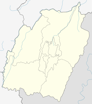 Tengnoupal Location in Manipur, India  Tengnoupal Tengnoupal (India) | |
| Coordinates: 24.328°N 93.986°E | |
| Country | |
| State | Manipur |
| District | Tengnoupal |
| Government | |
| • Type | Tribal chief |
| Elevation | 1,450 m (4,760 ft) |
| Population (2011) | |
| • Total | 2,158 |
| Languages | |
| • Official | Kuki |
| Time zone | UTC+5:30 (IST) |
| PIN | 795131 |
| Vehicle registration | MN |
| Coastline | 0 kilometres (0 mi) |
| Website | tengnoupal |
History
It was bombed by the British Royal Air Force(RAF) in 1942 during World War II. It was the most strategic location for the Army and Tengnoupal remained as the Army HQ.
In the 1960s and 1970s, Tengnoupal was the District Headquarter and it was shifted to Chandel in 1974. Though Tengnoupal is geographically strategical for installation of many Government infrastructures.
Political/Administration
It is the District headquarters of Tengnoupal District. Some notable government machineries stationed in the village are:
1. Deputy Commissioner/ District Magistrate Office
2. Superintendent of Police office
3. District Hospital.
5. Forest Range Office
6. Assam Rifles Battalion Headquarters since 1994
7. Tengnoupal Police Station
8. Zornal Education Officer
10. District Public Works Department
11. Chief Medical Office
The Chandel District was formerly known as Tengnoupal District until the change was effected on 13 May 1974.
Geography
The National Highway 2 snakes through Tengnoupal east to west. It is 69 km from Imphal. Nearest airport is Tulihal Airport. It is the highest point above sea-level on the Imphal-Moreh Highway.
Location (strategic significance)
The village is a transit point of some state highways, including the Tengnoupal-Sita-Sansak road and Tengnoupal-Joupi-New Samtal road.
Demography
Tengnoupal, with total 300 household residing, has population of 2158 of which 1477 are males while 681 are females as per Population Census 2011.
In Tengnoupal village population of children with age 0-6 is 140 which makes up 6.49% of total population of village. Average Sex Ratio of Tengnoupal village is 461 which is lower than Manipur state average of 992. Child Sex Ratio for the Tengnoupal as per census is 750, lower than Manipur average of 936.
Tengnoupal village has lower literacy rate compared to Manipur. In 2011, literacy rate of Tengnoupal village was 76.02% compared to 79.21% of Manipur. In Tengnoupal Male literacy stands at 84.75% while female literacy rate was 56.36%. [1]
Tourism
There is increasing the inflow of tourist every season. During monsoon, the place is foggy and makes it the best place for romance. Since Tengoupal is situated on the topmost range of the Indo-Myanmar region visitors could get a bird's eye view of the surrounding hills and the plains of Kabaw-Valley (Myanmar).
.jpg)
Besides, during summer the cold winds to sweep the hills of Tengnoupal which makes this place the most sought after for summer recreation for families.