Tautoro
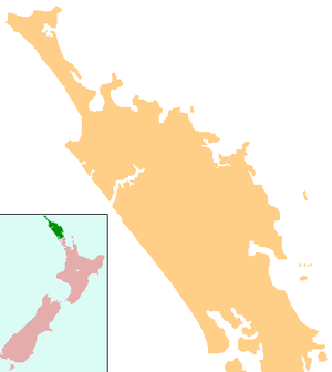
Tautoro is a locality about 8 km south-southeast of Kaikohe in Northland, New Zealand.[1] Further to the south is the Awarua rural community.[2]
Tautoro | |
|---|---|
 Tautoro | |
| Coordinates: 35°28′24″S 173°50′24″E | |
| Country | New Zealand |
| Region | Northland Region |
| District | Far North District |
History and culture
Tautoro has five Ngāpuhi marae:
- Kaikou Marae and Eparaima Makapi meeting house are affiliated with Ngāti Hine.
- Kaingahoa Mataraua Marae and Tūmanako meeting house are affiliated with Ngāi Tāwake ki te Waoku and Ngāti Rangi.
- Te Maata Marae and Te Whare Huinga are connected to Ngāti Moerewa and Ngāti Rangi.
- Māhūhū ki te Rangi Marae and meeting house belong to Ngāti Moerewa.
- Te Hungāiti is also a meeting ground for both hapū.[3][2]
The Awarua community has two Ngāpuhi marae:
Demographics
| Historical population | ||
|---|---|---|
| Year | Pop. | ±% p.a. |
| 2006 | 546 | — |
| 2013 | 477 | −1.91% |
| 2018 | 507 | +1.23% |
| Source: [4] | ||
The statistical area of Mataraua Forest, which at 272 square kilometres is much larger than this locality, had a population of 507 at the 2018 New Zealand census, an increase of 30 people (6.3%) since the 2013 census, and a decrease of 39 people (-7.1%) since the 2006 census. There were 168 households. There were 246 males and 261 females, giving a sex ratio of 0.94 males per female. Of the total population, 129 people (25.4%) were aged up to 15 years, 93 (18.3%) were 15 to 29, 231 (45.6%) were 30 to 64, and 57 (11.2%) were 65 or older. Figures may not add up to the total due to rounding.
Ethnicities were 45.0% European/Pākehā, 70.4% Māori, 5.3% Pacific peoples, 2.4% Asian, and 1.2% other ethnicities. People may identify with more than one ethnicity.
The percentage of people born overseas was 6.5, compared with 27.1% nationally.
Although some people objected to giving their religion, 42.6% had no religion, 43.2% were Christian, and 4.7% had other religions.
Of those at least 15 years old, 42 (11.1%) people had a bachelor or higher degree, and 84 (22.2%) people had no formal qualifications. The median income was $19,700. The employment status of those at least 15 was that 150 (39.7%) people were employed full-time, 51 (13.5%) were part-time, and 24 (6.3%) were unemployed.[4]
Education
Tautoro School is a coeducational full primary (years 1-8) school with a roll of 127 students as of March 2020.[5][6]
The school celebrated its centenary in 2006.[7] It was originally called Tautoro Native School.[8]
Notes
- Roger Smith, GeographX (2005). The Geographic Atlas of New Zealand. Robbie Burton. pp. map 23. ISBN 1-877333-20-4.
- "Māori Maps". maorimaps.com. Te Potiki National Trust.
- "Te Kāhui Māngai directory". tkm.govt.nz. Te Puni Kōkiri.
- "Statistical area 1 dataset for 2018 Census". Statistics New Zealand. March 2020. Mataraua Forest (104000). 2018 Census place summary: Mataraua Forest
- "New Zealand Schools Directory". New Zealand Ministry of Education. Retrieved 26 April 2020.
- Education Counts: Tautoro School
- "Tautoro School Centennial 2006". Education Gazette New Zealand.
- "History". Tautoro School. Retrieved 7 May 2020.