Tarso Toon
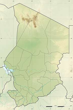
Tarso Toon (sometimes also known as Tarso Toh;[2] "Tarso" means "high plateau".[3]) is a volcano in the central Tibesti mountains.[4]
| Tarso Toon | |
|---|---|
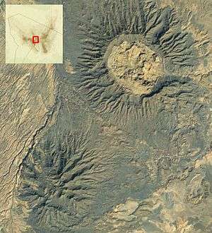 Tarso Toon is in the upper right corner | |
| Highest point | |
| Elevation | 2,575 m (8,448 ft) |
| Coordinates | 21.07°N 17.62°E [1] |
| Geography | |
 Tarso Toon | |
The volcano reaches a maximum height of 2,575 metres (8,448 ft) and a width of 21 by 19 kilometres (13 mi × 12 mi), covering a surface of 600 square kilometres (230 sq mi). It also features a caldera 11 by 12 kilometres (6.8 mi × 7.5 mi) wide,[1] with a gap on its northern side.[4]
It was active in the Miocene,[5] developing over older ignimbrites with tholeiitic rocks. Later, felsic volcanic rocks were emplaced within the caldera and the Voon ignimbrite buried parts of the tholeiite.[6]
References
- Permenter, JasonL.; Oppenheimer, Clive (1 April 2007). "Volcanoes of the Tibesti massif (Chad, northern Africa)". Bulletin of Volcanology. 69 (6): 615. doi:10.1007/s00445-006-0098-x. ISSN 0258-8900.
- Thesiger, Wilfred (1939). "A Camel Journey to Tibesti". The Geographical Journal. 94 (6): 433–446. doi:10.2307/1787293. JSTOR 1787293.
- Deniel et al. 2015, p. 19.
- Grove, A. T. (1960). "Geomorphology of the Tibesti Region with Special Reference to Western Tibesti". The Geographical Journal. 126 (1): 18–27. doi:10.2307/1790425. JSTOR 1790425.
- Deniel et al. 2015, p. 1.
- Deniel et al. 2015, p. 13.
Sources
- Deniel, C.; Vincent, P.M.; Beauvilain, A.; Gourgaud, A. (8 August 2015). "The Cenozoic volcanic province of Tibesti (Sahara of Chad): major units, chronology, and structural features". Bulletin of Volcanology. 77 (9): 1–21. doi:10.1007/s00445-015-0955-6. ISSN 0258-8900.CS1 maint: ref=harv (link)
See also
- Tarso Toh, an unrelated volcano
This article is issued from Wikipedia. The text is licensed under Creative Commons - Attribution - Sharealike. Additional terms may apply for the media files.