Tapawera
Tapawera is a small town in New Zealand's South Island. It is located 30 kilometres (19 mi) southwest of Nelson by the banks of the Motueka River. The population including the surrounding area was 396 in the 2013 census, a decrease of nine from 2006.[1] The town is a gateway to the Kahurangi National Park.[2]
Tapawera has a school, a local Four Square supermarket, a campground, a few cafes and a garage.
The geographic centre of New Zealand (including Stewart Island and some smaller islands in addition to the North and South Island, but excluding the Chatham Islands) was calculated in 1962 to be in a patch of unremarkable dense scrub in a forest in Spooners Range 12 km (7 miles) to the south of Tapawera: 41°30′S 172°50′E.[3]
Education
Tapawera Area School is a co-educational state area school for Year 1 to 13 students,[4] The school was established in 1942, through the merging of several schools in the area.[5] It has a roll of 186 as of March 2020.[6]
References
- 2013 Census QuickStats about a place : Tapawera
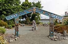
- Murdoch, Helen (24 October 2014). "Kahurangi gateway to be unveiled". Nelson Mail.
- "Nelson City Council website: ravitational centre". Archived from the original on 28 September 2007. Retrieved 27 August 2007.
- "Tapawera Area School Ministry of Education School Profile". educationcounts.govt.nz. Ministry of Education.
- "Tapawera Area School Official School Website". tapawera.school.nz.
- "Tapawera Area School Education Review Office Report". ero.govt.nz. Education Review Office.
External links
- Tapawera History - an overall history of the Tapawera area prepared by the Tapawera & Valleys Historical Society
- The Ferry Inn at Tapawera - a history focusing on the old accommodation house established at the future site of the Tapawera township