Toamasina
Toamasina (Malagasy pronunciation: [toˈmasinə̥]), meaning "like salt" or "salty", unofficially and in French Tamatave, is the capital of the Atsinanana region on the east coast of Madagascar on the Indian Ocean. The city is the chief seaport of the country, situated 215 km (134 mi) northeast of its capital and biggest city Antananarivo. According to the 2014 official estimate, Toamasina had a population of 300,813.[1] The city is served by Toamasina Airport.
Toamasina Tamatave | |
|---|---|
 Toamasina | |
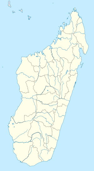 Toamasina Location in Madagascar | |
| Coordinates: 18°09′S 49°25′E | |
| Country | |
| Region | Atsinanana |
| Area | |
| • Total | 20 km2 (8 sq mi) |
| Population (2014) | |
| • Total | 300,813 |
| • Density | 15,000/km2 (39,000/sq mi) |
| Time zone | UTC3 (EAT) |
| Climate | Af |
History
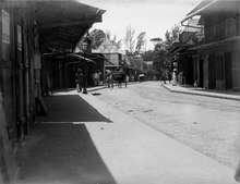
Under French rule, Toamasina was the seat of several foreign consuls, as well as of numerous French officials, and was the chief port for the capital and the interior. Imports consisted principally of piece-goods, farinaceous foods, and iron and steel goods; main exports were gold dust, raffia, hides, caoutchouc (rubber) and live animals. Communication with Europe was maintained by steamers of the Messageries Maritimes and the Havraise companies, and also with Mauritius, and thence to Sri Lanka, by the British Union-Castle Line.[2]
During the colonial period, owing to the character of the soil and the formerly crowded native population, the town was often plagued by epidemics: the plague broke out in 1898, and again in 1900; but since the draining of the neighboring marshes, there was an improvement. After 1895, the native population was removed from the town and settled in a new village to the north-west.[2]
Geography
Toamasina owes its importance to the existence of a coral reef which forms a spacious harbour, entered by two openings. The city center is built on a sandy peninsula which projects at right angles from the general coastline.
Climate
Toamasina features a trade-wind tropical rainforest climate under the Köppen climate classification. While Toamasina has no true dry season month where less than 60 millimetres (2.4 inches) of precipitation (on average) falls, the seaport has noticeably wetter and drier periods of the year. September–November is the driest period of the year, while February–April is the wettest time of the year. Average temperatures are relatively constant throughout the course of the year, though it is slightly cooler in the months of July and August, where average highs are around 24 °C (75 °F), and warmer in the months of January and February, where high temperatures on average are 30 °C (86 °F). Toamasina averages roughly 3,368.2 millimetres (132.61 inches) of precipitation annually.
| Climate data for Toamasina (1961–1990, extremes 1889–present) | |||||||||||||
|---|---|---|---|---|---|---|---|---|---|---|---|---|---|
| Month | Jan | Feb | Mar | Apr | May | Jun | Jul | Aug | Sep | Oct | Nov | Dec | Year |
| Record high °C (°F) | 37.4 (99.3) |
38.6 (101.5) |
36.7 (98.1) |
35.0 (95.0) |
34.0 (93.2) |
29.6 (85.3) |
31.2 (88.2) |
30.2 (86.4) |
30.6 (87.1) |
33.2 (91.8) |
33.0 (91.4) |
33.6 (92.5) |
38.6 (101.5) |
| Average high °C (°F) | 30.1 (86.2) |
30.3 (86.5) |
29.5 (85.1) |
28.8 (83.8) |
27.3 (81.1) |
25.6 (78.1) |
24.8 (76.6) |
24.9 (76.8) |
25.8 (78.4) |
26.9 (80.4) |
28.4 (83.1) |
29.4 (84.9) |
27.6 (81.7) |
| Daily mean °C (°F) | 26.0 (78.8) |
26.1 (79.0) |
25.5 (77.9) |
24.6 (76.3) |
22.9 (73.2) |
21.1 (70.0) |
20.4 (68.7) |
20.5 (68.9) |
21.3 (70.3) |
22.7 (72.9) |
24.3 (75.7) |
25.5 (77.9) |
23.4 (74.1) |
| Average low °C (°F) | 22.5 (72.5) |
22.7 (72.9) |
22.4 (72.3) |
21.4 (70.5) |
19.5 (67.1) |
17.8 (64.0) |
17.1 (62.8) |
17.0 (62.6) |
17.3 (63.1) |
18.7 (65.7) |
20.4 (68.7) |
21.9 (71.4) |
19.9 (67.8) |
| Record low °C (°F) | 18.0 (64.4) |
17.5 (63.5) |
17.0 (62.6) |
15.0 (59.0) |
13.2 (55.8) |
11.0 (51.8) |
11.8 (53.2) |
10.0 (50.0) |
11.0 (51.8) |
11.0 (51.8) |
13.5 (56.3) |
16.0 (60.8) |
10.0 (50.0) |
| Average rainfall mm (inches) | 410.1 (16.15) |
382.1 (15.04) |
478.4 (18.83) |
322.8 (12.71) |
228.3 (8.99) |
259.0 (10.20) |
288.6 (11.36) |
218.2 (8.59) |
121.1 (4.77) |
132.6 (5.22) |
169.7 (6.68) |
357.3 (14.07) |
3,368.2 (132.61) |
| Average rainy days (≥ 1.0 mm) | 19 | 17 | 21 | 18 | 17 | 18 | 22 | 20 | 15 | 13 | 14 | 17 | 211 |
| Average relative humidity (%) | 83 | 83 | 85 | 84 | 85 | 85 | 84 | 85 | 83 | 82 | 83 | 84 | 84 |
| Mean monthly sunshine hours | 224.7 | 198.2 | 191.0 | 196.9 | 192.1 | 162.5 | 162.8 | 184.6 | 209.7 | 232.7 | 236.0 | 219.2 | 2,410.4 |
| Source 1: NOAA[3] | |||||||||||||
| Source 2: Deutscher Wetterdienst (humidity, 1951–1967),[4] Meteo Climat (record highs and lows)[5] | |||||||||||||
Transport

The town is the railhead for the line to the capital. Pousse-pousse (bicycle rickshaws), tuk-tuk (motorized rickshaws), and taxis are available throughout Toamasina to get around the city. Toamasina is the northern end of the Canal des Pangalanes.
The port of Toamasina serves as Madagascar's most important gateway to the Indian Ocean and to the world.
The city is served by Ambalamanasy Airport, which has limited domestic and international service. The city is the country's main seaport for international shipping.
Education
The University of Toamasina was founded in 1977. A regional centre for distance education (CRTE) of the Centre National de Télé-Enseignement de Madagascar (CNETMAD) is also located in Toamasina.
Lycée Français de Tamatave, a French international school, is in Toamasina.
Places of worship
Among the places of worship, they are predominantly Christian churches and temples : Church of Jesus Christ in Madagascar (World Communion of Reformed Churches), Malagasy Lutheran Church (Lutheran World Federation), Assemblies of God, Association of Bible Baptist Churches in Madagascar (Baptist World Alliance), Roman Catholic Archdiocese of Toamasina (Catholic Church seated in the Cathedral of St. Joseph) and Iglesia Ni Cristo. [6] There are also Muslim mosques.
International relations
Twin towns — Sister cities
Toamasina is twinned with:

The city of Holon used to have a street named Tamatave Street (רחוב טמטב), named so in the 1960s when Israel had cordial relations with Madagascar. After the assassination of Rehav'am Ze'evi in 2001, the street was renamed after him.
Sports
Toamasina is home to the basketball club A.S.C.U.T., one of the top teams in the Malagasy N1A, Madagascar's prime basketball league.
See also
Notes
- Population data, Madagascar - Aires urbaines (2014), populationdata.net, accessed on June 3, 2019
- Chisholm 1911, p. 387.
- "Tamatave/Toamasina Climate Normals 1961–1990". National Oceanic and Atmospheric Administration. Retrieved October 19, 2015.
- "Klimatafel von Toamasina (Tamatave) / Madagaskar" (PDF). Baseline climate means (1961-1990) from stations all over the world (in German). Deutscher Wetterdienst. Retrieved April 7, 2017.
- "Station Toamasina" (in French). Meteo Climat. Retrieved April 7, 2017.
- J. Gordon Melton, Martin Baumann, ‘‘Religions of the World: A Comprehensive Encyclopedia of Beliefs and Practices’’, ABC-CLIO, USA, 2010, p. 1768
- Le Port est jumelé à quatre villes portuaires Archived 2015-09-08 at the Wayback Machine (in French)
References

External links
| Wikivoyage has a travel guide for Toamasina. |
- Map
- (in French) University of Toamasina
- (in French) Regional Tourist information office - Toamasina
- (in French) Regional Harbour of Toamasina
- (in French) https://web.archive.org/web/20170225132257/http://mairie-toamasina.mg/ City Hall of toamasina ]
- (in French) http://www.adopt-tamatave.com/ Association of the native of toamasina ]