Tárcoles River
The Tárcoles River, also called the Grande de Tárcoles River or the Río Grande de Tarcoles, in Costa Rica originates on the southern slopes of the Cordillera Central volcanic range and flows in a south-westerly direction to the Gulf of Nicoya.[1] The river is 111 kilometres (69 mi) long and its watershed covers an area of 2,121 square kilometres (819 sq mi),[1] which encompasses around 50% of the country's population.
| Tárcoles River | |
|---|---|
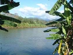 View from near Carara | |
| Location | |
| Country | Costa Rica |
| Physical characteristics | |
| Source | |
| ⁃ location | Cordillera Central |
| Mouth | |
⁃ location | Gulf of Nicoya |
⁃ coordinates | 9.786315°N 84.641175°W |
⁃ elevation | 0 m (0 ft) |
| Length | 111 km (69 mi) |
| Basin size | 2,121 km2 (819 sq mi) |
The river's watershed drains approximately 67% of Costa Rica's untreated organic and industrial waste and is considered the most contaminated river basin in the country.[1][2]
The river's upper reaches form the northern border of the Carara Biological Reserve.[1] It is a habitat for American crocodiles, while the marshes located at the river's mouth have many waterfowl and wading birds. Among the many herons and egrets are the boatbill and bare-throated tiger heron, and other birds found here include double-striped thick-knee, mangrove warbler and American pygmy kingfisher.
Reptiles, such as the American crocodile, caiman, common basilisk and large iguanas, are also easily seen.
References
- Ballestero, Maureen (2003). "Tárcoles River Basin, Costa Rica: Background Paper" (PDF). worldbank.org.
- Sebastian Rodriguez (1 March 2017). "Tárcoles: The most contaminated river in Central America". AIDA. Retrieved 2019-02-05.