Surgidero de Batabanó
Surgidero de Batabanó, also shortened as Surgidero, is a Cuban village and consejo popular ("people's council", i.e. hamlet) of the municipality of Batabanó, in Mayabeque Province.[1] In 2011 it had a population of about 6,000.[2]
Surgidero de Batabanó Surgidero | |
|---|---|
Village | |
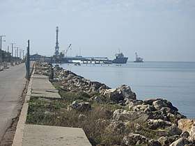 The port of Surgidero | |
.png) OSM map showing Surgidero and its port | |
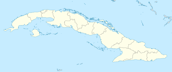 Location of Surgidero in Cuba | |
| Coordinates: 22°41′14.6″N 82°17′37.7″W | |
| Country | |
| Province | Mayabeque |
| Municipality | Batabanó |
| Founded | 1688[1] |
| Elevation | 5 m (16 ft) |
| Population (2011)[2] | |
| • Total | 6,000 |
| Time zone | UTC-5 (EST) |
| Area code(s) | +53-7 |
History
The village was officially founded on February 5, 1688.[1]
Geography
Located by the Caribbean Coast, on the Gulf of Batabanó, Surgidero is a coastal village surrounded by a marsh, that lies 3 km south of Batabanó.[3] It is 22 km from Melena del Sur, 24 from Quivicán, 30 from Playa Mayabeque, 32 from Güira de Melena, 37 from Güines, San José de las Lajas and Bejucal, and 54 from Havana city centre.
Transport
The Port of Surgidero, built in the 16th century, is the main port for the communication to Isla de la Juventud (to Nueva Gerona) and Cayo Largo del Sur, with ferryboat and passenger regular services.[4]
The local railway station[5] is the southern terminus of the Havana-Surgidero line, part of the Havana Suburban Railway network. The village is 3 km far from the state highway "Circuito Sur" (CS).
Gallery
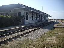 Surgidero station
 A village's road
References
- (in Spanish) Surgidero de Batabanó on EcuRed
- Source: Mapa de Carreteras de Cuba (Road map of Cuba). Ediciones GEO, Havana 2011 - ISBN 959-7049-21-X
- 649898072 Surgidero de Batabanó on OpenStreetMap
- Sea transport in Nueva Gerona (Lonely Planet)
- 3123303323 Surgidero de Batabanó railway station on OpenStreetMap
External links
| Wikimedia Commons has media related to Surgidero de Batabanó. |
- Surgidero de Batabanó on Lonely Planet
- Surgidero de Batabanó Weather on accuweather.com