Sungai Durian, Kotabaru
Sungai Durian, or "Durian River", is a district (Indonesian: Kecamatan) of Kotabaru Regency in the province of South Kalimantan, Indonesia. The population is entirely rural.
Sungai Durian | |
|---|---|
District | |
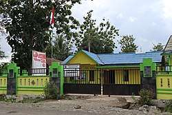 Gendang Timburu village office in Sungai Durian | |
 Sungai Durian | |
| Coordinates: 2.597703°S 115.969071°E | |
| Country | Indonesia |
| Province | South Kalimantan |
| Regency | Kotabaru |
| Population (2010) | |
| • Total | 10,400 |
Geography
The district capital is Manunggal Lama. Sungai Durian is bordered on the north by the districts of North Pamukan and Pamukan West; on the east by the district of Sampanahan; on the south by the district of Kelumpang West; and on the west by the district of Juai, Hulu Sungai Utara.[1] The district has an area of 1,042.38 square kilometres (402.47 sq mi) and an average elevation of 5 metres (16 ft) above sea level.[1] It contains seven villages:[1][2]
| Name | Area (km2 | Percentage | Pop. 2010 |
|---|---|---|---|
| Gendang Timburu | 559.16 | 53.62 | 918 |
| Manunggal Baru | 28.96 | 2.78 | 744 |
| Manunggal Lama | 111.07 | 10.68 | 4,443 |
| Rantau Buda | 100.12 | 9.60 | 1,231 |
| Rantau Jaya | 7.50 | 0.72 | 637 |
| Terombong Sari | 6.30 | 0.60 | 565 |
| Buluh Kuning | 229.70 | 22.03 | 1,862 |
Sungai Durian is in the Kutai Basin, which holds a major coal formation created from the Early Pliocene to the Eocene.[3]
Demographics
The district had a total population of 10,400 as of the 2010 census, all considered rural. Of these 5,610 were male and 4,790 female.[4] The breakdown by religion was Islam: 7,029, Christian: 1,130, Catholic: 283, Hindu: 117, Buddhist: 1,104, Other: 737.[5]
Notes
Sources
- 19 Kecamatan Sungai Durian (in Indonesian), Badan Perencanaan Pembangunan Daerah, retrieved 2017-01-23
- Penduduk Menurut Wilayah, Daerah Perkotaan/Perdesaan, dan Jenis Kelamin: Kabupaten Kotabaru (in Indonesian), BPS: Badan Pusat Statistik, retrieved 2017-01-23
- Penduduk Menurut Wilayah dan Agama yang Dianut: Kabupaten Kotabaru (in Indonesian), BPS: Badan Pusat Statistik, retrieved 2017-01-23
- Population of Indonesia by Village: Result of 2010 Population Census (PDF), Central Bureau of Statistics (BPS - Statistics Indonesia), archived from the original (PDF) on 2015-02-07, retrieved 2017-01-23
- Sumaatmadja, Eddy R., "Inventarisasi Batubara Di Daerah Lintas Provinsi Daerah Sungai Durian", Badan Geologi (in Indonesian), retrieved 2017-01-23