Starachowice County
Starachowice County (Polish: powiat starachowicki) is a unit of territorial administration and local government (powiat) in Świętokrzyskie Voivodeship, south-central Poland. It came into being on January 1, 1999, as a result of the Polish local government reforms passed in 1998. Its administrative seat and largest town is Starachowice, which lies 37 kilometres (23 mi) north-east of the regional capital Kielce. The only other town in the county is Wąchock, lying 5 km (3 mi) north-west of Starachowice.
Starachowice County Powiat starachowicki | |
|---|---|
 Flag  Coat of arms | |
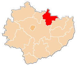 Location within the voivodeship | |
| Coordinates (Starachowice): 51°3′N 21°4′E | |
| Country | |
| Voivodeship | Świętokrzyskie |
| Seat | Starachowice |
| Gminas | Total 5 (incl. 1 urban)
|
| Area | |
| • Total | 523.27 km2 (202.04 sq mi) |
| Population (2006) | |
| • Total | 94,395 |
| • Density | 180/km2 (470/sq mi) |
| • Urban | 55,852 |
| • Rural | 38,543 |
| Car plates | TST |
| Website | http://www.powiat.starachowice.pl |
The county covers an area of 523.27 square kilometres (202.0 sq mi). As of 2006 its total population is 94,395, out of which the population of Starachowice is 53,092, that of Wąchock is 2,760, and the rural population is 38,543.
Neighbouring counties
Starachowice County is bordered by Radom County to the north, Lipsko County and Ostrowiec County to the east, Kielce County to the west, and Skarżysko County and Szydłowiec County to the north-west.
Administrative division
The county is subdivided into five gminas (one urban, one urban-rural and three rural). These are listed in the following table, in descending order of population.
| Gmina | Type | Area (km²) |
Population (2006) |
Seat |
| Starachowice | urban | 31.9 | 53,092 | |
| Gmina Pawłów | rural | 137.4 | 15,064 | Pawłów |
| Gmina Brody | rural | 161.3 | 10,811 | Brody |
| Gmina Mirzec | rural | 111.0 | 8,456 | Mirzec |
| Gmina Wąchock | urban-rural | 81.8 | 6,972 | Wąchock |
References
| Seat |
| |
|---|---|---|
| Urban-rural gmina | ||
| Rural gminas | ||
| City counties |
|  |
|---|---|---|
| Land counties | ||