Piz Tschütta
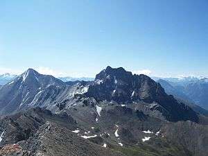
Piz Tschütta (also known as Stammerspitz) is a mountain of the Samnaun Alps, overlooking Samnaun in the canton of Graubünden. With an elevation of 3,254 metres (10,676 ft) above sea level, it is the second highest mountain of the Samnaun Alps.
| Piz Tschütta | |
|---|---|
| Stammerspitz | |
 | |
| Highest point | |
| Elevation | 3,254 m (10,676 ft) |
| Prominence | 406 m (1,332 ft) [1] |
| Parent peak | Muttler |
| Isolation | 2.6 km (1.6 mi) |
| Coordinates | 46°54′13.4″N 10°20′36.2″E |
| Geography | |
 Piz Tschütta Location in Switzerland | |
| Location | Graubünden, Switzerland |
| Parent range | Samnaun Alps |
It lies about 3 km north-west from the Muttler, the highest mountain of the Samnaun Alps. The first ascent was on 16. August 1884 by K. Schulze, Johann Nell and Seraphim Kuppelwieser.[2]
| Wikimedia Commons has media related to Stammerspitze. |
References
- Retrieved from the Swisstopo topographic maps. The key col is located east of the mountain at 2,848 metres.
- Deutscher Alpenverein; Österreichischer Alpenverein; Alpenverein Südtirol, eds. (1982), Alpine Club Guide Samnaun Alps [Alpenvereinsführer Samnaungruppe] (in German) (2 ed.), München: Rother, pp. 204–213, ISBN 3-7633-1241-2
This article is issued from Wikipedia. The text is licensed under Creative Commons - Attribution - Sharealike. Additional terms may apply for the media files.