South Fork Ninnescah River
The South Fork Ninnescah River is a river in the central Great Plains of North America. Its entire length lies within the U.S. state of Kansas. It is a tributary of the Ninnescah River.[2]
| South Fork Ninnescah River | |
|---|---|
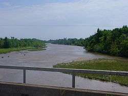 The South Fork Ninnescah River south of Murdock, Kansas (2006) | |
| Location | |
| Country | United States |
| State | Kansas |
| Physical characteristics | |
| Source | |
| • location | Pratt County, Kansas |
| • coordinates | 37°36′20″N 98°55′42″W[1] |
| • elevation | 2,071 ft (631 m) |
| Mouth | Ninnescah River |
• location | Sedgwick County, Kansas |
• coordinates | 37°34′05″N 97°42′19″W[1] |
• elevation | 1,302 ft (397 m) |
| Basin features | |
| Watersheds | South Fork Ninnescah- Ninnescah-Arkansas- Mississippi |
Geography
The South Fork Ninnescah River originates in south-central Kansas in the High Plains. Its source lies in west-central Pratt County approximately 2 miles (3.2 km) southwest of Cullison, Kansas. From there, it flows generally east into the Wellington Lowlands. In southwestern Sedgwick County, it meets the North Fork Ninnescah River to form the Ninnescah River.[2]
See also
References
- "South Fork Ninnescah River". Geographic Names Information System. United States Geological Survey. Retrieved 2015-10-19.
- "2003-2004 Official Transportation Map" (PDF). Kansas Department of Transportation. Retrieved 2015-10-19.
| Authority control |
|
|---|
This article is issued from Wikipedia. The text is licensed under Creative Commons - Attribution - Sharealike. Additional terms may apply for the media files.