Sirius Knoll
Sirius Knoll (63°43′S 58°36′W) is a conspicuous ice-covered knoll, 1,010 m, situated 2.28 km north-northeast of Mount Schuyler and marking the northeast end of Detroit Plateau in the central part of Trinity Peninsula in Antarctica. Surmounting Russell West Glacier to the north. Charted in 1946 by the Falkland Islands Dependencies Survey (FIDS) and named after Sirius, the dog star.
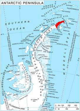
Location of Trinity Peninsula.
Map
- Trinity Peninsula. Scale 1:250000 topographic map No. 5697. Institut für Angewandte Geodäsie and British Antarctic Survey, 1996.
References
![]()
![]()
This article is issued from Wikipedia. The text is licensed under Creative Commons - Attribution - Sharealike. Additional terms may apply for the media files.