Siple Island
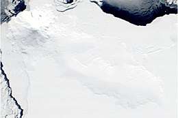
Siple Island is a 110 km (68 mi) long snow-covered island lying east of Wrigley Gulf along the Getz Ice Shelf off Bakutis Coast of Marie Byrd Land, Antarctica. Its centre is located at 73°51′S 125°50′W.
 | |
 Siple Location of Siple Island | |
| Geography | |
|---|---|
| Location | Antarctica |
| Coordinates | 73°51′S 125°50′W |
| Area | 6,390 km2 (2,470 sq mi) |
| Area rank | 100th |
| Length | 110 km (68 mi) |
| Highest elevation | 3,110 m (10,200 ft) |
| Highest point | Mount Siple |
| Administration | |
| Administered under the Antarctic Treaty System | |
| Demographics | |
| Population | Uninhabited |
Its area is 6,390 km2 (2,467 sq mi) and it is dominated by the dormant shield volcano Mount Siple, rising to 3,110 m (10,203 ft) — making this the 15th ranking island in the world by maximum elevation.
The feature was first indicated as an island on U.S. Geological Survey (USGS) maps compiled from ground surveys and U.S. Navy air photos, 1959–65.
Island and mountain were named by the United States Advisory Committee on Antarctic Names (US-ACAN) in 1967 in honour of the Antarctic explorer Paul A. Siple (1909–1968), member of Admiral Byrd's expeditions.
See also
- Composite Antarctic Gazetteer
- List of Antarctic and sub-Antarctic islands
- List of Antarctic islands south of 60° S
- List of volcanoes in Antarctica
- Recely Bluff - bluff on northeast slope of Mount Siple.
- Scientific Committee on Antarctic Research
- Territorial claims in Antarctica
References
