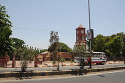
Silvassa
Silvassa (Gujarati: સેલવાસ, Hindi: सिलवासा) is a city and municipality in western India. It is the headquarters of the Dadra and Nagar Haveli district of the union territory of Dadra and Nagar Haveli and Daman and Diu, India. The city has many factories and industries providing significant government revenue, which allows the city to maintain a low level of taxation. The city was chosen as one of the hundred Indian cities in Narendra Modi's flagship Smart Cities Mission.
Silvassa સેલવાસ | |
|---|---|
City | |
 Silvassa Riverfront | |
 Silvassa | |
| Coordinates: 20.27°N 73.02°E | |
| Country | |
| Union territory | |
| District | Dadra and Nagar Haveli |
| Government | |
| • Type | Municipal Council |
| • Body | Silvassa Municipal Council |
| • Mayor | Rakeshsinh Chauhan |
| Area | |
| • Total | 16 km2 (6 sq mi) |
| Elevation | 32 m (105 ft) |
| Population (2011) | |
| • Total | 98,265 |
| • Density | 6,100/km2 (16,000/sq mi) |
| Languages | |
| • Official | Gujarati, English, Hindi |
| Time zone | UTC+5:30 (IST) |
| Telephone code | 0260 |
| Vehicle registration | DD-01 |
History
Until the end of the 19th century, Silvassa was only a small village. The growing importance of Silvassa started in 1885 when the Portuguese Administration decided to transfer the seat of Nagar Haveli to the city, which until then had been in Darará. By decree of 11 February 1885, Silvassa was created as a town, with the name of Vila de Paço d'Arcos. However, the original name prevailed and the town continued to be mainly known as Silvassa and referred to as such in official documents.
Language
Gujarati, Marathi and Hindi are the commonly spoken languages. Since the city lies in the northern part of Nagar Haveli, Gujarati language and its dialects are widely spoken as compared to the southern part of Nagar Haveli where Marathi, Konkani and its dialects hold prominence. Silvassa, being a cosmopolitan, is home to people from every part of India and hence every Indian language is spoken here such as Hindi, Bhojpuri, Marathi, Odia, Malayalam, Bengali, Kannada, Marwadi etc. A former Portuguese colony, Silvassa has a significant Roman Catholic population. There are still a few people who speak Portuguese as their first language.
Industry
.jpg)
Far from being a tribal region, Silvassa has now developed into an industrial hub with major industrial companies setting up manufacturing bases in the region. Its initial tax-free status granted by the Indian government to boost industrial investment in the former Union Territory of Dadra and Nagar Haveli has contributed to the region's industrial growth. The industrial landscape of Silvassa and surrounding region has been altered dramatically. It is one of the largest states in collection of excise duty from more than 3,500 small and medium industries. Silvassa is a big hub for plastic products and its products are found throughout India thanks to their good quality and low cost.Apart from all this Silvassa is also known for various FMCG distributors like Gajra Distribution having reach throughout the country.
Silvassa hosts more than 200,000 floating population, coming from all parts of the country, mostly the labourers hail from Uttar Pradesh, Bihar and Odisa. Other floating community being from the states of Madhya Pradesh, Maharashtra, Gujarat, Kerala, Karnataka, Tamil Nadu, Andhra Pradesh, and Rajasthan.
Transport and connections
Silvassa is connected to Maharashtra and Gujarat via National Highway 848A.[2] Silvassa has a well-maintained road network. The nearest railway stations are in Vapi 16 kilometres (9.9 mi) away and Bhilad, 14 kilometres (8.7 mi) away. Daman is 30 km away via Bhilad on National Highway number 8. Mumbai is 160 km away from Silvassa, via Bhilad, on National Highway number 8 Surat is 130 km away from Silvassa, via Bhilad, on National Highway number 8. Auto-rickshaw services ply between Vapi and Silvassa at a regular interval and easily available from Vapi (E) railway station. Gujarat Road Transport Buses ply between Silvassa and Vapi at a regular interval.
See also
References
| Wikimedia Commons has media related to Silvassa. |
- "Census of India 2001: Data from the 2001 Census, including cities, villages and towns (Provisional)". Census Commission of India. Archived from the original on 16 June 2004. Retrieved 1 November 2008.
- "New National Highways notification - NH 848A" (PDF). The Gazette of India. 17 April 2013. Archived (PDF) from the original on 21 May 2018. Retrieved 20 May 2018.