Sierra Baguales
Sierra Baguales or Sierra de los Baguales is a mountain range in the southernmost Andes. Sierra Baguales is a 60 kilometres (37 mi) long east-west chain, secondary to the main chain of the Andes that lie further west.[1][2] It lies along the border between Chile and Argentina near the localities of Puerto Natales and Río Turbio.
| Sierra Baguales | |
|---|---|
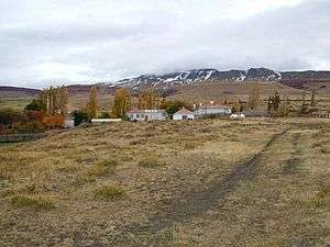 View to north of Cerro Guido and Estancia Cerro Guido | |
| Highest point | |
| Peak | Cerro Ciudadela |
| Elevation | 2,084 m (6,837 ft) |
| Dimensions | |
| Length | 60 km (37 mi) east-west |
| Geography | |
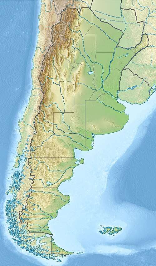 Location of Sierra Baguales in Argentina | |
| Country | |
| State/Province | Santa Cruz Province Magallanes |
| Range coordinates | 50°44′S 72°24′W |
| Parent range | Andes |
| Geology | |
| Age of rock | Late Eocene-Early Miocene |
| Type of rock | sedimentary rock igneous sills |
Geology
The mountain range contains a series of cirques formed by glaciers.[2] Many cirques developed in the Pleistocene Epoch from isolated glaciers that existed separedly from ice sheets further west.[2] The rocks of Sierra Baguales belong to various formations of Magallanes Basin.[3] These rocks contain fossils of plants, mammals and marine invertebrates.[3]
Stratigraphy
From top to bottom the following formations make up Sierra Baguales:[3]
- Santa Cruz Formation, sedimentary rocks belonging to a non-marine succession and hosting many vertebrate fossils[4]
- Estancia 25 de Mayo Formation, a succession of fossil-bearing sedimentary rocks that date to the Early Miocene. Sediments were deposited in a marine environment.
- La Cumbre Formation, an olivine-bearing gabbro sill
- Río Leona Formation, a succession of non-marine fossils, some of which contain Nothofagus fossils
- Bandurrías Formation, an olivine-bearing gabbro sill
- Loreto Formation, sedimentary rocks variously assigned a Late Eocene to Early Miocene age. Contains fossil shark teeth.
On the eastern slopes of Sierra Baguales various lithic artifacts have been found.[1] Human occupation of eastern foothills begun no later than 4,500 years before present.[1]
References
- Karen B., Borrazzo (2008). "Análisis tecnológico de distribuciones artefactuales en la periferia sudeste de la Sierra Baguales (Santa Cruz, Argentina)" [Technological analysis of surface artifact distributions in the southeastern end of Baguales Range (Santa Cruz, Argentina)]. Magallania (in Spanish). 36 (1). doi:10.4067/S0718-22442008000100008.
- Araos, José M.; Le Roux, Jacobus P.; Kaplan, Michael R.; Spagnolo, Matteo (2018). "Factors controlling alpine glaciations in the Sierra Baguales Mountain Range of southern Patagonia (50º S), inferred from the morphometric analysis of glacial cirques". Andean Geology. 45 (3). doi:10.5027/andgeoV45n3-2974.
- Bostelmann, Enrique; Le Roux, Jacobus P.; Vasquez, Ana; Gutiérrez, Nestor; Oyarzún, José Luis; Carreño, Catalina; Torres, Teresa; Otero, Rodrigo; Llanos, Andrea; Fanning, C. Mark; Nielsen, Sven. N.; Hervé, Francisco (2012). A revised lithostratigraphy of the Sierra Baguales, Magallanes Basin (PDF). XIII Congeso Geológico Chileno. pp. 698–700.
- Bostelmann et al., 2013
Bibliography
- Bostelmann, J. Enrique; Jacobus P. Le Roux; Ana Vásquez; Néstor M. Gutiérrez; José Luis Oyarzún; Catalina Carreño; Teresa Torres; Rodrigo Otero, and Andrea Llanos, C. Mark Fanning, Francisco Hervé. 2013. Burdigalian deposits of the Santa Cruz Formation in the Sierra Baguales, Austral (Magallanes) Basin: Age, depositional environment and vertebrate fossils. Andean Geology 40. 458–489. Accessed 2019-02-28.