Sidbury, Shropshire
Sidbury is a village and civil parish 21 miles (34 km) south-east of Shrewsbury,[1] in the county of Shropshire, England. In 2001 the parish had a population of 32.[2][3] Sidbury shared a parish council with Stottesdon.[4] The parish touches Stottesdon, Deuxhill, Middleton Scriven and Billingsley.[5]
| Sidbury | |
|---|---|
 | |
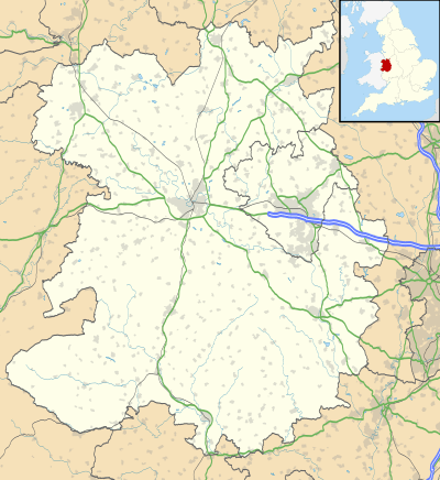 Sidbury Location within Shropshire | |
| Area | 5.20 km2 (2.01 sq mi) |
| Population | 32 (2001 census) |
| • Density | 6/km2 (16/sq mi) |
| OS grid reference | SO684856 |
| Civil parish |
|
| Unitary authority |
|
| Shire county | |
| Region | |
| Country | England |
| Sovereign state | United Kingdom |
Features
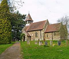
There are nine listed buildings in Sidbury.[6] Sidbury has a church called Holy Trinity Church.[7]
History
The name Sidbury means "south fortification".[8] Sidbury was recorded in the Domesday Book as Sudberie.[9] There are earthworks of Sidbury deserted medieval village.[10]
References
- "Distance from Sidbury [52.467417, -2.466578]". GENUKI. Retrieved 18 June 2019.
- 2001 census
- "Sidbury". City population. Retrieved 18 June 2019.
- "Stottesdon and Sidbury Parish Council". Shropshire Council. Retrieved 18 June 2019.
- "Sidbury". Ordnance Survey. Retrieved 18 June 2019.
- "Listed Buildings in Sidbury, Shropshire". British Listed Buildings. Retrieved 18 June 2019.
- "CHURCH OF HOLY TRINITY". Historic England. Retrieved 18 June 2019.
- "Sidbury Key to English Place-names". The University of Nottingham. Retrieved 18 June 2019.
- "Shropshire M-S". The Domesday Book Online. Retrieved 18 June 2019.
- Historic England, "Sidbury (112846)", PastScape, retrieved 18 June 2019
| Wikimedia Commons has media related to Sidbury. |
This article is issued from Wikipedia. The text is licensed under Creative Commons - Attribution - Sharealike. Additional terms may apply for the media files.