Shatt al Gharsah
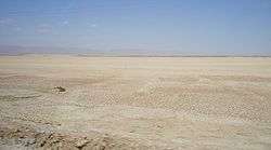
Shatt al Gharsah, Chott el Gharsa (Arabic language شط الغرسة) is sedimentary basin and also intermittent salt lake in Tunisia. It has width of 20 kilometres and length of 50 kilometres. At 17 metres under sea level it is at the lowest point of the country.[1]
| Shatt al Gharsah | |
|---|---|
 | |
 Shatt al Gharsah Shatt al Gharsah in Tunisia | |
| Coordinates | 34.07°N 7.52°E |
| Type | Salt lake, sedimentary basin |
| Primary inflows | rain |
| Primary outflows | terminal Evaporation |
| Basin countries | Tunisia |
| Max. length | 50 km (31 mi) |
| Max. width | 20 km (12 mi) |
| Surface area | 1,000 km2 (390 sq mi) |
| Surface elevation | −17 m (−56 ft) |
| Wikimedia Commons has media related to Chott el Gharsa. |
References
- "Chott El-Jarid lake, Tunisia". Encyclopedia Britannica. Retrieved 20 February 2018.
This article is issued from Wikipedia. The text is licensed under Creative Commons - Attribution - Sharealike. Additional terms may apply for the media files.