Sawmill Mountain
Sawmill Mountain is located on the county line between Kern and Ventura counties in California.[1] The mountain is located in the Chumash Wilderness and its summit is the highest point in Kern County and the second highest in the Los Padres National Forest. Mount Pinos has an elevation of 8,847 feet (2,697 m) and tops Sawmill Mountain as the highest in Ventura County by 29 feet.
| Sawmill Mountain | |
|---|---|
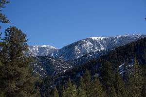 Sawmill Mt. to the right with Mt. Pinos to the left. | |
| Highest point | |
| Elevation | 8,822 ft (2,689 m) NAVD 88[1] |
| Prominence | 418 ft (127 m) [1] |
| Listing | California county high points 23rd Hundred Peaks Section[2] |
| Coordinates | 34°48′49″N 119°10′02″W [3] |
| Geography | |
| Location | Kern and Ventura counties, California, U.S. |
| Topo map | USGS Sawmill Mountain |
| Climbing | |
| Easiest route | Trail hike[2] |
References
- "Sawmill Mountain, California". Peakbagger.com. Retrieved 2009-08-13.
- "Sawmill Mountain". Hundred Peaks Section List. Angeles Chapter, Sierra Club.
- "Sawmill Mountain". Geographic Names Information System. United States Geological Survey. Retrieved 2009-08-13.
External links
- "Chumash Wilderness". Wilderness.net. Retrieved 2009-08-13.
- "Kern County High Point Trip Report". County Highpointers. Retrieved 2009-08-13.
This article is issued from Wikipedia. The text is licensed under Creative Commons - Attribution - Sharealike. Additional terms may apply for the media files.