Satpuli
Satpuli is a town on Meerut-Pauri highway, located at a distance of approximately 50 kilometres from Kotdwar and 50 kilometers from Pauri, in Pauri Garhwal district of Uttarakhand.
Satpuli | |
|---|---|
Town | |
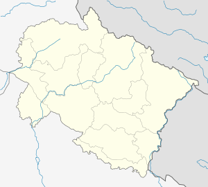 Satpuli Location in Uttarakhand, India  Satpuli Satpuli (India) | |
| Coordinates: 29°55′0″N 78°42′0″E | |
| Country | |
| State | Uttarakhand |
| District | Pauri Garhwal |
| Elevation | 657 m (2,156 ft) |
| Population | |
| • Total | >10,000 |
| Languages | |
| • Official | Garhwali, Hindi |
| Time zone | UTC+5:30 (IST) |
| PIN | 246172 |
| Telephone code | 01386 |
| Vehicle registration | UK |
| Nearest city | Pauri & Kotdwar |
| Avg. summer temperature | 25–40 °C (77–104 °F) |
| Avg. winter temperature | 1–30 °C (34–86 °F) |
| Website | uk |
Location
Satpuli is situated on the southern banks of Nayaar (East) river and at a distance of 1 kilometre from the confluence of Nayaar(East) and Nayaar(West) rivers. It is also connected to Banghat, which is where the unified Nayaar river meets Ganga river. Satpuli is one of the blocks ofPauri Garhwal district with its block office at Satpuli town.There is also a hospital by Hans Foundation located at Chamolsain near satpuli.It is main pathway to whole pauri garhwal district . Satpuli block covers 263 villages.[1] It is 52 km from Pauri and 54 km from Kotdwara.
History
It is said that Satpuli got its name from the fact that it has seven bridges (saat-pul) on its way from Kotdwara. Until a few decades ago this place used to be a farmland. Gradually, some hut-like shops sprang up at the other bank of river. In the year 1951 Satpuli witnessed a massive flood, leading to loss of life and livestock, many people died that year. Some of the shops and note-worthy buildings such as office of G.M.O.U. Pvt. Ltd. was swept away. Later, shopkeepers resettled at the present location. A memorial has been erected at the hydle power station in the memory of people who died in the great flood of the Nayaar river ralley. Satpuli is famous for its Maaccha Bhaat (Fish curry and Rice) and as a halting/resting place for travelers where they have lunch and dinner enroute Kotdwar, Pauri, Srinagar or higher reaches of Nayaar valley. Now it is a Town Area.
Infrastructure
At present, the town is growing at a rapid rate and has expanded in an unorganized way leading to garbage, drainage and sanitary problems which are generally very hard to find in mountains. It is hailed as a prime place for shopping by villagers from the nearby villages. They come here for grocery and other consumables. It has four banks namely SBI, Syndicate Bank, Zila Sahkari Bank and Utarakhand Grameen Bank. Syndicate Bank opened in 2014 and since then, has been the main financial organization for Satpuli and all the nearby villages. Over the last couple of decades a lot of Army veterans & their families (specifically from Garhwal Rifles) as well as old people have settled here after transferring their pension accounts to the nearby banks. Satpuli is also emerging as a new institutional area in the district after the establishment of Government Polytechnic College, Degree College, Navodaya Vidyalaya-Khairasaim, Sriverm ITI,Swami Ram Polytechnic-Toli and some public schools. Besides this a handful of clinics and hospitals serve the town and the surrounding rural areas like Sri Hans Hospital.[2]
Attractions
Satpuli is an ideal place for angling and fishing as both the Nayaar (East) and Nayaar (West) rivers are teeming with different fishes. The variety and number of fishes further increases after the confluence of these two rivers. Besides a multitude of aquatic animals, Freshwater Eel (known as Gaid in Garhwali), a local variety of spotted Catfish (known as Kaana in Garhwali) and Anchhyaal (a kind of river carp) are the famous ones. Crabs, river snakes, otters, water birds and periwinkles can also be seen. Other than exploring the surrounding terrain, rivers, and enjoying the sights of nature, there is virtually nothing that can be done here. Besides this, nearby tourist destinations can be visited. Lansdowne, which is perhaps the calmest, cleanest and the least crowded hill-station, is only 30 kilometers away from here. It is an enjoyable journey of 1 hour by winding hilly roads and as you climb up from 2200 feet at Satpuli to 6000 feet at Lansdowne, you can feel a drastic change in the climate. Lansdowne is also known for its jungle safari. Yet, there is one thing that far exceeds the others in number, i.e. temples. There is no shortage of temples in Uttarakhand and Pauri district is no different. One can visit Jwalpa Devi Temple, Bhuveneshwari Devi Temple (near the confluence of Nayaar and Ganga), Bhairav Garhi (A medieval Garhwali fortress and temple at a height of 7200 feet). Satpuli celebrates Ramleela, Grishmotsava, Sharadotsava and many festive occasions which are visited by multitudes of people.Jwalpa Devi Temple is the Famous Temple of Satpuli which is located on the road of pauri which is about 19.2 km far from satpuli.
Geography and Climate
At an elevation of 657 metres above sea level (approximately 2200 feet), Satpuli has a warm temperate climate similar to Srinagar (Garhwal) and Dehradun. Under the Köppen climate classification, Satpuli has a combination of Subtropical Monsoon (Cwa) and Subtropical Highland (Cwb) climates. Temperature can range from the lowest of -1 to maximum of 45 degrees Celsius. March & November are the most pleasant months, January is the coldest whereas June is the hottest. During summer days, owing to its altitude, it is just a few degrees cooler than the national capital.
References
- "List of Villages in Satpuli Tehsil | villageinfo.in". villageinfo.in. Retrieved 25 January 2018.
- "The Hans Foundation Hospitals - Billions In Change". Billions In Change. Retrieved 25 January 2018.
External links
| Wikimedia Commons has media related to Satpuli. |
Gallery
 Satpuli On NH-119
 Dangleshwar Mahadev
 Maa Bhuvneshwari Temple
 Satpuli Aerial View
 View of Satpuli from Bhanghat Road