Sarclet
Sarclet is a remote clifftop crofting township, situated on the east coast of Caithness, lying slightly north of Loch Sarclet in the Scottish Highlands and is in the Scottish council area of Highland.
| Sarclet | |
|---|---|
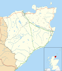 Sarclet Location within the Caithness area | |
| OS grid reference | ND352435 |
| Council area | |
| Lieutenancy area | |
| Country | Scotland |
| Sovereign state | United Kingdom |
| Post town | Thrumster |
| Postcode district | KW1 5 |
| Police | Scotland |
| Fire | Scottish |
| Ambulance | Scottish |
Sarclet Head extends into the sea and is 0.5 miles to the southeast of the township. Sarclet has a natural harbour called The Haven which was formerly used by fishing boats, but is now largely unused.[1]
The village of Thrumster lies 0.5 miles north west, with Wick located 5 north of the township.
Decoy Site
Sarclet was a location for a Q/QF large-scale night-time decoy airfield during World War II, that were used to simulate burning cities. The site was used to provide some protection for Wick.[2]
References
- North sea pilot. Pt. 1. 2nd- ed. [With] Suppl. [and] Admiralty notices to mariners. [1st] [With] Suppl. [and] Admiralty notices to mariners. 1868. p. 50. Retrieved 25 December 2017.
- Stichelbaut, Birger; Bourgeois, Jean; Saunders, Nicholas (18 December 2008). Images of Conflict: Military Aerial Photography and Archaeology. Cambridge Scholars Publishing. p. 273. ISBN 978-1-4438-0314-4. Retrieved 25 December 2017.
This article is issued from Wikipedia. The text is licensed under Creative Commons - Attribution - Sharealike. Additional terms may apply for the media files.