Santa Catarina Island
Santa Catarina Island (Portuguese: Ilha de Santa Catarina) is an island in the Brazilian state of Santa Catarina, located off the southern coast. It is home to the state capital, Florianópolis.
| Native name: Ilha de Santa Catarina Nickname: Ilha da Magia | |
|---|---|
 Santa Catarina Island | |
| Geography | |
| Coordinates | 27°36′S 48°30′W |
| Area | 424.4 km2 (163.9 sq mi) |
| Administration | |
Brazil | |
| State | Santa Catarina |
| Demographics | |
| Population | 421,203 (2010) |
| Pop. density | 602.29/km2 (1,559.92/sq mi) |
Location
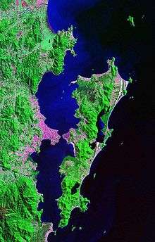
Santa Catarina Island is approximately 54 km (33 mi) long (measuring north-south) by 18 km (11 mi) wide, measuring east-west at its widest point (in the north of the island), with a total area of 424.4 km² (163.9 mi²). The island is the largest of an archipelago of more than 30 islands, the majority of which lie within the Florianópolis municipality. Nearby islands also part of the archipelago, but which belong to other cities, include: Anhatomirim Island, Cabras Island, Arvoredo Island, Deserta Island and Galés Island.
The three main bridges, Hercílio Luz Bridge (closed since 1991), Colombo Salles Bridge and Pedro Ivo Campos Bridge, span a 500-meter wide and 28-meter deep channel which delimits the north and south bays of the island. One of the continental neighborhoods in Florianópolis is named after this strait.
Urban areas
Santa Catarina Island is home to the state capital, Florianópolis, and is connected to the mainland by three bridges, two of which are currently in operation. The island also contains numerous beach resorts, including: Jurerê Internacional, Santinho, Canasvieiras and Cachoeira do Bom Jesus.
A large part of the city of Florianópolis lies within the borders of the island. The downtown area lies in the mid-west, but many other neighborhoods and districts are spread over the island. One notable neighborhood is Trindade, where the Federal University of Santa Catarina (UFSC) is located. In the north, the communities of Ingleses, Canasvieiras and Jurerê can be found, and those of Vargem Grande and Vargem Pequena are in the far north. The neighborhoods Santo Antônio de Lisboa, Cacupé, Sambaqui, Barra do Sambaqui, Rio Vermelho and Praia da Daniela are located in the northwest. To the south lie Pântano do Sul, Costa de Dentro, Caieira da Barra do Sul and Ribeirão da Ilha, though Costa de Cima is in the mid-south. Morro das Pedras and Armação do Pântano do Sul lie in the southeast. The east contains the communities Barra da Lagoa, Lagoa da Conceição, Rio Tavares and Campeche. Other neighborhoods on the island include Carvoeira, Córrego Grande, Itacorubi, Pantanal, Parque São Jorge, and Santa Mônica.
Conservation
The Carijós Ecological Station was established by decree of 20 July 1987, covering an area of 7.5933 square kilometres (2.9318 sq mi) in the municipality. It preserves a significant area of mangroves on the Ilha de Santa Catarina.[1] The Pirajubaé Marine Extractive Reserve in the south bay of the Ilha de Santa Catarina protects people engaged in traditional harvesting of marine resources, mainly shellfish, from the sandbanks of the bay.[2] The tip of the island is in the 84,130 hectares (207,900 acres) Serra do Tabuleiro State Park, a protected area created in 1975.[3] The 1,532 hectares (3,790 acres) Rio Vermelho State Park, created in 2007, is in the northeast of the island.[4]
Tourism
Santa Catarina states at the top of ranks of the most beautiful place to visit in Brazil. This part of Brazil has a touch of everything: dense jungle, glimmering beaches, great nightlife, wild nature, Latin flare, European influence. The most impressive places to visit are São Joaquim National Park, Serra do Rio do Rastro, surf at Joaquina, Lagoinha do Leste, Florianópolis city.[5][6]This is one of the smaller states in the country, meaning that exploring all the places is very manageable.
References
- Estação Ecológica de Carijós (in Portuguese), Ministerio do Meio Ambiente, retrieved 2016-04-15
- Reserva Extrativista Marinha Pirajubaé (in Portuguese), MMA, retrieved 2016-06-04
- "Parque Estadual da Serra do Tabuleiro", Ponta do Papagaio (in Portuguese), retrieved 2016-06-11
- Parque Estadual do Rio Vermelho (in Portuguese), FATMA: Fundação do Meio Ambiente, retrieved 2017-01-21
- Lees, Will. "The Top 10 Things to See and Do in Santa Catarina, Brazil". Culture Trip. Retrieved 2019-11-16.
- "Florianopolis 2019: Best of Florianopolis, Brazil Tourism". TripAdvisor. Retrieved 2019-11-16.