Sampit
Sampit is a town and a timber port on the Sampit River in the Central Kalimantan province on the island of Borneo, Indonesia. It is the seat of East Kotawaringin Regency. Sampit is the biggest timber port in all of Indonesia.[1]
Sampit | |
|---|---|
Town | |
| Other transcription(s) | |
 | |
 Sampit | |
| Coordinates: 2°32′S 112°57′E | |
| Country | Indonesia |
| Province | Central Kalimantan |
| Regency | East Kotawaringin Regency |
| Elevation | 25 m (82 ft) |
| Time zone | UTC+7 (WIB) |
Sampit is also known as Sampit, Tanah Hevea. According to reported data as of August 2009, the estimated population of Sampit is 66,053. The average elevation of the town is 25 metres (82 ft).[2]
History
Sampit town became known worldwide following inter-ethnic violent communal clashes between the Dayaks and the Madurese during the Sampit conflict which broke out on February 17, 2001 and lasted for 10 days.[3] There are a number of stories purportedly describing the incident that sparked the violence in 2001. One version claims that it was caused by an arson attack on a Dayak house. Rumours spread that the fire was caused by Madurese, and later a group of Dayaks began burning houses in a Madurese neighbourhood.[4] Another version says that the massacre was triggered by an earlier incident in December 2000 when a Dayak man was killed by three Madurese.[5]
In just two weeks 469 were reported to have been killed, of which 456 of them were Madurese.[3] Virtually the entire Madurese people fled and "ethnic cleansing" has taken place in Sampit and surrounding areas, despite the Madurese previously forming about 60% of the population.[5] However, according to a BBC report, the overall picture of the conflict caused 500 deaths, with over 100,000 Madurese displaced from their homes.[6] Many Madurese were also found decapitated by the Dayaks.[7] Several hundreds of the immigrants fled from the area and moved by naval vessels to their homes in Madura island in East Java.
Geography
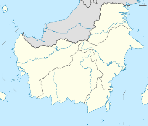
Sampit lies in southern-mid Borneo on the banks of the Sampit River also called the "Mentaya River"[8] is a river of Central Kalimantan in Borneo.[9] The river takes its name from the town of Sampit which is situated on the bank of river not too distant from the Java Sea.[10] The Schwaner mountain range extends with long hill ridges southwards, separating the major river systems of the area, most notably the Bukit Baka hill range which extends down to Sampit Bay.[11] The area between the town of Sampit and the coast was historically heavily forested but has since been reduced due to road construction and development projects.[11]
To the north of Sampit, on the road to Pangkalanbun, is an area of peat-swamp forest.[12]
Sampit is 20 kilometres (12 mi) from the mouth of the river.[13] Road networks connect to the capital cities of the regency and one such road is the Palangkaraya-Sampit-Purukcahu. However, river transport is the common transport for communications. Apart from navigational approach from the Java Sea and inland road network, Sampit also has the Sampit Airport (IATA: SMQ, ICAO: WAOS),[14] also known as H. Asan Airport,[15] is a public airport in Sampit, Central Kalimantan, Indonesia. Airline services are provided by the Wings Air to Banjarmasin, Palangkaraya, and Pangkalan Bun, Express Air to Jakarta, and Semarang, and the Nam Air to Jakarta and Surabaya.
Landmarks
Important landmarks in the area are the Pandaran Beach at the mouth of the Sampit River, the Orchid Park of Pembuangan Hulu and hunting park of Kotawaringin at the border.[16]
- Pandaran Beach
This beach is located towards the sea side at the mouth of Sampat River. It is developed as a park. Its uniqueness lies in the fact that a river debouches into the sea on its northern side while the Java Sea provides a wide expanse of water on its southern side.[16]
- Orchid Park of Pembuangan Hulu
The Orchid Park is part of the Pembuangan Hulu. It has a galaxy of orchid plants.[16]
References
- "Central Kalimantan". Indonesia Tourism. Retrieved 5 January 2011.
- "Population of Sampit, Indonesia". Mongabay.com. Archived from the original on 17 July 2011. Retrieved 8 January 2011.
- Fischer, Horst; McDonald, Avril; Dugard, John; Hans-Peter Gasser; Christopher Greenwood; Hortensia Gutierrez Posse; G. Herczeg; William Fenrick (23 May 2004). Yearbook of International Humanitarian Law:. Cambridge University Press. p. 539. ISBN 978-90-6704-169-0. Retrieved 5 January 2011.
- "Indonesia: The Violence in Central Kalimantan (Borneo)". Human Rights Watch. February 28, 2001. Retrieved 2008-08-13.
- Abdullah, Taufik (2009). Indonesia: towards democracy. Institute of Southeast Asian Studies. p. 552. ISBN 978-981-230-366-0. Retrieved 5 January 2011.
- "Indonesia flashpoints: Kalimantan". BBC. June 28, 2004. Retrieved 2008-08-13.
- "Horrors of Borneo massacre emerge". BBC. February 27, 2001. Retrieved 2008-08-13.
- "Central Kalimantan". Indahnesia.com. Retrieved October 30, 2010.
- Rand McNally, The New International Atlas, 1993.
- "Kalimantan". Consulate of the Republic of Indonesia to the Republic of Armenia. Retrieved October 30, 2010.
- Rijksen, H. D.; Meijaard, E. (30 June 1999). Our vanishing relative: the status of wild orang-utans at the close of the twentieth century. Springer. p. 213. ISBN 978-0-7923-5754-4. Retrieved 5 January 2011.
- Sarawak; Unesco. South East Asia Science Cooperation Office (1965). Symposium on Ecological Research in Humid Tropics Vegetation. pp. 217–23. Retrieved 5 January 2011.
- Geographical Dictionary of the World. Concept Publishing Company. p. 1631. ISBN 978-81-7268-012-1. Retrieved 9 January 2011.
- Great Circle Mapper: SMQ / WAOS – Sampit, Borneo, Indonesia
- Airport information for WAOS – H.Asan Airport at World Aero Data. Data current as of October 2006.
- "Kalimantan". Indonesia travel Organization. Archived from the original on 12 September 2008. Retrieved 8 January 2011.