Sakaide, Kagawa
Sakaide (坂出市, Sakaide-shi) is a city located in Kagawa Prefecture, Japan. Sakaide once flourished with salt production.[1]
Sakaide 坂出市 | |
|---|---|
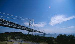 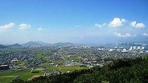 Upper stage: Great Seto Bridge Lower stage: Skyline of Sakaide city | |
 Flag  Emblem | |
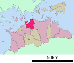 Location of Sakaide in Kagawa Prefecture | |
 Sakaide Location in Japan | |
| Coordinates: 34°19′N 133°52′E | |
| Country | Japan |
| Region | Shikoku |
| Prefecture | Kagawa Prefecture |
| Government | |
| • Mayor | Toshiaki Matsuura |
| Area | |
| • Total | 92.46 km2 (35.70 sq mi) |
| Population (May 1, 2017) | |
| • Total | 52,281 |
| • Density | 570/km2 (1,500/sq mi) |
| Symbols | |
| • Tree | Sangoju (Viburnum odoratissimum var. awabuki) |
| • Flower | Sakura and Cosmos |
| Time zone | UTC+9 (JST) |
| City hall address | 2-3-5, Muromachi, Sakaide-shi, Kagawa-ken 762-8601 |
| Website | www |
As of May 2017, the city has an estimated population of 52,281 and a population density of 570 persons per km².[2] The total area is 92.46 km².
The city was founded on July 1, 1942. The Great Seto Bridge connects it with Kurashiki, Okayama Prefecture across the Inland Sea.
Notable places
- Kagawa Prefectural Higashiyama Kaii Setouchi Art Museum , (Kaii Higashiyama`s Art Museum)[3]
- Mountain Iino (Kagawa's Mount Fuji)[4]
- Kiyama (A castle ruin of Yamato court)[5]
- Shōtsu-ji Castle (A castle ruin, Ikoma Chikamasa and Sengoku Hidehisa were commander of the castle)[6]
- Shinto shrine (misasagi) (Emperor Sutoku's Tomb)
- Tennō-ji Temple (79th of Shikoku Pilgrimage.)
- Shiromine-ji Temple (81st of Shikoku Pilgrimage.)
- Fuchu Dam (Lake Fuchu)
- Great Seto Bridge
Gallery
 Mountain Iino
.JPG) Lake Fuchu
Lake Fuchu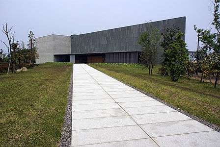 Kaii Higashiyama Art Museum
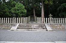 Memorial Shinto shrine and mausoleum honoring Emperor Sutoku
 Shiramine Shrine
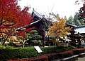 Shiromine-ji Temple
%2C_zenkei.jpg) Kiyama
Kiyama%2C_Jomon.jpg) Kiyama's gate and stone wall
Kiyama's gate and stone wall
Transportation
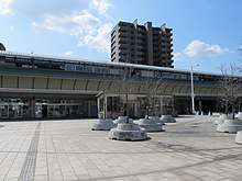
Sakaide Station
Festivals
- Sakaide Tengu Festival
- Sakaide Salt Festival (May)
- Sakaide Ohashi Festival (August)
Twin towns – sister cities

References
- "塩業資料館 " (in Japanese). Sakaide city official. Retrieved 25 July 2019.
- "Official website of Sakaide City" (in Japanese). Japan: Sakaide City. Retrieved 9 May 2017.
- "香川県立東山魁夷せとうち美術館 " (in Japanese). Kaii Higashiyama`s Art Museum official. Retrieved 25 July 2019.
- "飯野山" (in Japanese). Sakaide cityofficial. Retrieved 25 July 2019.
- "城山 " (in Japanese). 香川のみどり百選. Retrieved 25 July 2019.
- "常盤公園" (in Japanese). 坂出市. Retrieved 25 July 2019.
External links
| Wikimedia Commons has media related to Sakaide, Kagawa. |
- Sakaide City official website (in Japanese)
| Authority control |
|
|---|
This article is issued from Wikipedia. The text is licensed under Creative Commons - Attribution - Sharealike. Additional terms may apply for the media files.