Sainte-Honorine-des-Pertes
Sainte-Honorine-des-Pertes is a former commune in the Calvados department in the Normandy region in northwestern France. On 1 January 2017, it was merged into the new commune Aure sur Mer.[2]
Sainte-Honorine-des-Pertes | |
|---|---|
Part of Aure sur Mer | |
 | |
Location of Sainte-Honorine-des-Pertes 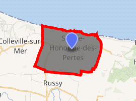
| |
 Sainte-Honorine-des-Pertes  Sainte-Honorine-des-Pertes | |
| Coordinates: 49°20′53″N 0°48′22″W | |
| Country | France |
| Region | Normandy |
| Department | Calvados |
| Arrondissement | Bayeux |
| Canton | Trévières |
| Commune | Aure sur Mer |
| Area 1 | 5.69 km2 (2.20 sq mi) |
| Population (2017-01-01)[1] | 541 |
| • Density | 95/km2 (250/sq mi) |
| Time zone | UTC+01:00 (CET) |
| • Summer (DST) | UTC+02:00 (CEST) |
| Postal code | 14520 |
| Elevation | 0–78 m (0–256 ft) (avg. 70 m or 230 ft) |
| 1 French Land Register data, which excludes lakes, ponds, glaciers > 1 km2 (0.386 sq mi or 247 acres) and river estuaries. | |
History
World War II
On 13 September 1942 13 British commandos landed at night near Sainte-Honorine-des-Pertes from a Motor Torpedo Boat in Operation Aquatint, a reconnaissance mission to collect information about the surrounding area, and take a German guard prisoner.[3]
Sainte-Honorine-des-Pertes is located at the eastern end of Omaha Beach, one of the landings sites on D-Day, 6 June 1944, at the beginning of the Battle of Normandy, during World War II.
Population
| Historical population | ||
|---|---|---|
| Year | Pop. | ±% |
| 1962 | 333 | — |
| 1968 | 293 | −12.0% |
| 1975 | 310 | +5.8% |
| 1982 | 371 | +19.7% |
| 1990 | 391 | +5.4% |
| 1999 | 415 | +6.1% |
| 2008 | 582 | +40.2% |
See also
References
- "Populations légales 2017". INSEE. Retrieved 6 January 2020.
- Arrêté préfectoral 9 December 2016 (in French)
- Operation Aquatint
| Wikimedia Commons has media related to Sainte-Honorine-des-Pertes. |
| Authority control |
|
|---|
This article is issued from Wikipedia. The text is licensed under Creative Commons - Attribution - Sharealike. Additional terms may apply for the media files.