Saint-Pierre-de-Lamps
Saint-Pierre-de-Lamps is a former commune in the Indre department in central France. On 1 January 2019, it was merged into the commune Levroux.[2]
Saint-Pierre-de-Lamps | |
|---|---|
Part of Levroux | |
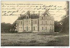 An old postcard view of the château | |
Location of Saint-Pierre-de-Lamps 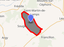
| |
 Saint-Pierre-de-Lamps  Saint-Pierre-de-Lamps | |
| Coordinates: 46°58′19″N 1°30′48″E | |
| Country | France |
| Region | Centre-Val de Loire |
| Department | Indre |
| Arrondissement | Châteauroux |
| Canton | Levroux |
| Commune | Levroux |
| Area 1 | 10.28 km2 (3.97 sq mi) |
| Population (2017-01-01)[1] | 54 |
| • Density | 5.3/km2 (14/sq mi) |
| Time zone | UTC+01:00 (CET) |
| • Summer (DST) | UTC+02:00 (CEST) |
| Postal code | 36110 |
| Elevation | 138–185 m (453–607 ft) (avg. 140 m or 460 ft) |
| 1 French Land Register data, which excludes lakes, ponds, glaciers > 1 km2 (0.386 sq mi or 247 acres) and river estuaries. | |
Population
| Historical population | ||
|---|---|---|
| Year | Pop. | ±% |
| 1793 | 245 | — |
| 1800 | 213 | −13.1% |
| 1806 | 222 | +4.2% |
| 1821 | 232 | +4.5% |
| 1831 | 255 | +9.9% |
| 1836 | 246 | −3.5% |
| 1841 | 243 | −1.2% |
| 1846 | 224 | −7.8% |
| 1851 | 202 | −9.8% |
| 1856 | 224 | +10.9% |
| 1861 | 216 | −3.6% |
| 1866 | 186 | −13.9% |
| 1872 | 174 | −6.5% |
| 1876 | 189 | +8.6% |
| 1881 | 210 | +11.1% |
| 1886 | 216 | +2.9% |
| 1891 | 189 | −12.5% |
| 1896 | 193 | +2.1% |
| 1901 | 188 | −2.6% |
| 1906 | 186 | −1.1% |
| 1911 | 178 | −4.3% |
| 1921 | 183 | +2.8% |
| 1926 | 166 | −9.3% |
| 1931 | 151 | −9.0% |
| 1936 | 163 | +7.9% |
| 1946 | 140 | −14.1% |
| 1954 | 146 | +4.3% |
| 1962 | 117 | −19.9% |
| 1968 | 86 | −26.5% |
| 1975 | 81 | −5.8% |
| 1982 | 60 | −25.9% |
| 1990 | 56 | −6.7% |
| 1999 | 44 | −21.4% |
| 2006 | 43 | −2.3% |
| 2009 | 43 | +0.0% |
See also
Ancienne carte postale du château de Saint-Pierre de Lamps dans l'Indre
References
- "Populations légales 2017". INSEE. Retrieved 6 January 2020.
- Arrêté préfectoral 24 August 2018 (in French)
| Wikimedia Commons has media related to Saint-Pierre-de-Lamps. |
| Authority control |
|
|---|
This article is issued from Wikipedia. The text is licensed under Creative Commons - Attribution - Sharealike. Additional terms may apply for the media files.