Saint-Nicolas-de-Bliquetuit
Saint-Nicolas-de-Bliquetuit is a former commune in the Seine-Maritime department in the Normandy region in northern France. On 1 January 2016, it was merged into the new commune of Arelaune-en-Seine.[1]
Saint-Nicolas-de-Bliquetuit | |
|---|---|
Part of Arelaune-en-Seine | |
Location of Saint-Nicolas-de-Bliquetuit 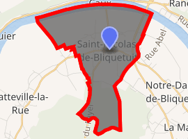
| |
 Saint-Nicolas-de-Bliquetuit  Saint-Nicolas-de-Bliquetuit | |
| Coordinates: 49°30′32″N 0°43′48″E | |
| Country | France |
| Region | Normandy |
| Department | Seine-Maritime |
| Arrondissement | Rouen |
| Canton | Notre-Dame-de-Gravenchon |
| Commune | Arelaune-en-Seine |
| Area 1 | 9.23 km2 (3.56 sq mi) |
| Population (2006) | 534 |
| • Density | 58/km2 (150/sq mi) |
| Time zone | UTC+01:00 (CET) |
| • Summer (DST) | UTC+02:00 (CEST) |
| Postal code | 76940 |
| Elevation | 1–54 m (3.3–177.2 ft) (avg. 10 m or 33 ft) |
| 1 French Land Register data, which excludes lakes, ponds, glaciers > 1 km2 (0.386 sq mi or 247 acres) and river estuaries. | |
Geography
A farming village situated in a meander of the river Seine, some 20 miles (32 km) northwest of Rouen at the junction of the D40, D65 and the D490 roads. The 60m high Pont de Brotonne bridge was, until the middle of the last century, the first crossing point of the Seine.
Population
| Year | 1962 | 1968 | 1975 | 1982 | 1990 | 1999 | 2006 |
|---|---|---|---|---|---|---|---|
| Population | 271 | 276 | 371 | 476 | 533 | 492 | 534 |
| From the year 1962 on: No double counting—residents of multiple communes (e.g. students and military personnel) are counted only once. | |||||||
Places of interest
- The church of St. Nicholas, dating from the eleventh century.
References
- Arrêté préfectoral 16 December 2015 (in French)
| Wikimedia Commons has media related to Saint-Nicolas-de-Bliquetuit. |
| Authority control |
|
|---|
This article is issued from Wikipedia. The text is licensed under Creative Commons - Attribution - Sharealike. Additional terms may apply for the media files.