Saint-Maurice-de-Rotherens
Saint-Maurice-de-Rotherens is a former commune in the Savoie department in the Auvergne-Rhône-Alpes region in south-eastern France. On 1 January 2019, it was merged into the new commune Saint-Genix-les-Villages.[2]
Saint-Maurice-de-Rotherens | |
|---|---|
Part of Saint-Genix-les-Villages | |
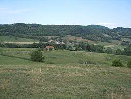 A general view of Saint-Maurice de Rotherens | |
Location of Saint-Maurice-de-Rotherens 
| |
 Saint-Maurice-de-Rotherens  Saint-Maurice-de-Rotherens | |
| Coordinates: 45°37′18″N 5°41′57″E | |
| Country | France |
| Region | Auvergne-Rhône-Alpes |
| Department | Savoie |
| Arrondissement | Chambéry |
| Canton | Bugey savoyard |
| Commune | Saint-Genix-les-Villages |
| Area 1 | 8.17 km2 (3.15 sq mi) |
| Population (2017-01-01)[1] | 213 |
| • Density | 26/km2 (68/sq mi) |
| Time zone | UTC+01:00 (CET) |
| • Summer (DST) | UTC+02:00 (CEST) |
| Postal code | 73240 |
| Elevation | 376–880 m (1,234–2,887 ft) |
| 1 French Land Register data, which excludes lakes, ponds, glaciers > 1 km2 (0.386 sq mi or 247 acres) and river estuaries. | |
Geography
The commune is located on the ridge of Mont Tournier. Saint-Maurice-de-Rotherens is located 1,6 km from Gresin and 1,6 km from Gerbaix.
Demographics
During the last census in 2012, the commune had 211 residents.
See also
References
- "Populations légales 2017". INSEE. Retrieved 6 January 2020.
- Arrêté préfectoral 23 October 2018 (in French)
| Wikimedia Commons has media related to Saint-Maurice-de-Rotherens. |
| Authority control |
|
|---|
This article is issued from Wikipedia. The text is licensed under Creative Commons - Attribution - Sharealike. Additional terms may apply for the media files.