Saint-Brice-en-Coglès
Saint-Brice-en-Coglès (Breton: Sant-Brizh-Gougleiz) is a former commune in the Ille-et-Vilaine department in Brittany in northwestern France. On 1 January 2017, it was merged into the new commune Maen-Roch.[2]
Saint-Brice-en-Coglès Sant-Brizh-Gougleiz | |
|---|---|
Part of Maen-Roch | |
.jpg) Town hall | |
 Coat of arms | |
Location of Saint-Brice-en-Coglès 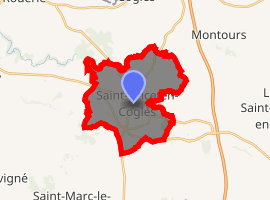
| |
 Saint-Brice-en-Coglès  Saint-Brice-en-Coglès | |
| Coordinates: 48°24′41″N 1°21′57″W | |
| Country | France |
| Region | Brittany |
| Department | Ille-et-Vilaine |
| Arrondissement | Fougères-Vitré |
| Canton | Antrain |
| Commune | Maen-Roch |
| Area 1 | 16.46 km2 (6.36 sq mi) |
| Population (2017-01-01)[1] | 3,026 |
| • Density | 180/km2 (480/sq mi) |
| Time zone | UTC+01:00 (CET) |
| • Summer (DST) | UTC+02:00 (CEST) |
| Postal code | 35460 |
| Elevation | 80–124 m (262–407 ft) |
| 1 French Land Register data, which excludes lakes, ponds, glaciers > 1 km2 (0.386 sq mi or 247 acres) and river estuaries. | |
Geography
Saint-Brice-en-Coglès is located at 46 km (29 mi) northeast of Rennes and 29 km (18 mi) south of Mont Saint-Michel. The neighboring communes are Coglès, La Selle-en-Coglès, Saint-Étienne-en-Coglès, Baillé, Saint-Marc-le-Blanc, and Tremblay.
Population
Inhabitants of Saint-Brice-en-Coglès are called briçois in French.
| Historical population | ||
|---|---|---|
| Year | Pop. | ±% |
| 1962 | 1,962 | — |
| 1968 | 2,045 | +4.2% |
| 1975 | 2,403 | +17.5% |
| 1982 | 2,477 | +3.1% |
| 1990 | 2,484 | +0.3% |
| 1999 | 2,395 | −3.6% |
| 2009 | 2,758 | +15.2% |
References
- "Populations légales 2017". INSEE. Retrieved 6 January 2020.
- Arrêté préfectoral 29 August 2016 (in French)
External links
| Wikimedia Commons has media related to Saint-Brice-en-Coglès. |
- Geography of Brittany
- The page of the commune on infobretagne.com
- French Ministry of Culture list for Saint-Brice-en-Coglès (in French)
| Authority control |
|
|---|
This article is issued from Wikipedia. The text is licensed under Creative Commons - Attribution - Sharealike. Additional terms may apply for the media files.