Saint-Béat
Saint-Béat (Gascon: Sent Biat) is a commune in the Haute-Garonne department in southwestern France. On 1 January 2019, it was merged into the new commune Saint-Béat-Lez.[2]
Saint-Béat | |
|---|---|
Part of Saint-Béat-Lez | |
.JPG) The Garonne river and the village of Saint-Béat | |
.svg.png) Coat of arms | |
Location of Saint-Béat 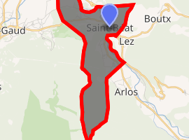
| |
 Saint-Béat  Saint-Béat | |
| Coordinates: 42°54′54″N 0°41′36″E | |
| Country | France |
| Region | Occitanie |
| Department | Haute-Garonne |
| Arrondissement | Saint-Gaudens |
| Canton | Bagnères-de-Luchon |
| Commune | Saint-Béat-Lez |
| Area 1 | 7.37 km2 (2.85 sq mi) |
| Population (2016-01-01)[1] | 351 |
| • Density | 48/km2 (120/sq mi) |
| Time zone | UTC+01:00 (CET) |
| • Summer (DST) | UTC+02:00 (CEST) |
| Postal code | 31440 |
| Elevation | 476–1,760 m (1,562–5,774 ft) (avg. 500 m or 1,600 ft) |
| 1 French Land Register data, which excludes lakes, ponds, glaciers > 1 km2 (0.386 sq mi or 247 acres) and river estuaries. | |
Sites and monuments
- Château de Saint-Béat, 12th century castle
- The Pic du Gar is a striking limestone mountain in the area.
Population
| Historical population | ||
|---|---|---|
| Year | Pop. | ±% |
| 1962 | 687 | — |
| 1968 | 755 | +9.9% |
| 1975 | 611 | −19.1% |
| 1982 | 543 | −11.1% |
| 1990 | 547 | +0.7% |
| 1999 | 364 | −33.5% |
| 2008 | 394 | +8.2% |
_-_Fonds_Ancely_-_B315556101_A_MALBOS_1_010.jpg)
Saint-Béat by Eugène de Malbos, near 1840.
References
- "Populations légales 2016". INSEE. Retrieved 25 April 2019.
- Arrêté préfectoral 30 April 2018 (in French)
| Wikimedia Commons has media related to Saint-Béat. |
| Authority control |
|
|---|
This article is issued from Wikipedia. The text is licensed under Creative Commons - Attribution - Sharealike. Additional terms may apply for the media files.